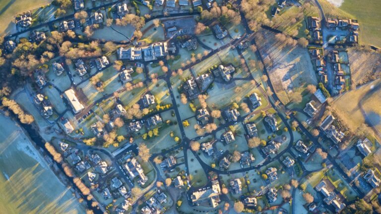
It is a considerable challenge to inspect the suitability of the land when engaging in urban development. Urban development in Australia involves some heavy work including planning, maintenance, and making maximum use of the available resources for development. That is why Australia needs the utilisation of certain technology that can assist them in streamlining their urban development projects. Geographic Information Systems or known as GIS is a cutting-edge software solution that is immensely beneficial in such mega projects.
In this article, you will discover the implementation of GIS technology in Australian urban development and how it optimises those operations accordingly.
What is GIS Technology?
GIS is a computer-based tool used to store, visualise, analyse, and interpret geographic data. The geographic position of features is determined by geographic data, often known as spatial or geospatial data. These data consist of anything that can be mapped and connected to a specific location on the Earth. For instance, addresses, national borders, and highways are all examples of spatial data.
The government uses GIS to assist in responding to inquiries regarding how geography affects sickness and disability in many land-related businesses. GIS is being used by thousands of organisations throughout the globe to create maps that facilitate communication, analysis, information sharing, and the resolution of challenging issues. Concerning the land, this is altering how the world operates.
Key Ways How GIS Technology Optimises Urban Development Efforts

Improved Mapping
The use of GIS technology dramatically improves urban development. GIS ensures that maps remain current, which improves the accuracy of development plans by centralising both historical data and current data on maps in a single source. Also, it increases the impact of thematic mapping by helping to emphasise particular urban features. The method also lowers the cost of data storage, freeing up resources for other development requirements.
This simplified method improves urban planning and keeps maps up-to-date, enabling smarter decisions. Through effective mapping, GIS plays a critical role in promoting informed growth and resource management, which benefits cities and their residents.
Opens Door to Vital Information
There are basically two major types of GIS information. For processing data from various sources, desktop GIS and cloud GIS provide practical options. Data administration, access, and storage are made simpler by desktop GIS, typically on a single computer. It enables users to effectively produce, analyse, and visualise geographic information. By enabling data storage and access through the internet from any device, Cloud GIS, on the other hand, broadens these benefits.
Geographical obstacles are eliminated by this revolutionary technology, allowing for seamless cooperation and real-time updates. A flexible and adaptable environment that supports projects of all sizes is provided by cloud GIS. In this framework, desktop GIS and cloud GIS both have major roles to play.
Enhanced Communication
An organisation’s operations are transformed when a unified system for data management and storage is established. This system serves as a central centre for keeping track of critical data. Inside the organisation, everyone has easy access to it. There is no longer a need to spend a lot of time browsing through files or hard disks. The new approach streamlines the process.
Now, finding the appropriate information when needed is really straightforward. As a result, things run more smoothly, less of the same information needs to be said, and mistakes are made less frequently. By arming them with the appropriate information, it also enables them to collaborate and make wise decisions.
Upgraded Quality and Efficiency
GIS serves as a solid link between the people and the government. To conveniently exchange crucial information, it makes use of a specialised website. The government can swiftly distribute essential news, updates, and new regulations thanks to this dedicated website.
However, ordinary individuals can access this website on their own to immediately locate the precise information they want. It functions similarly to a convenient library that you can access at any moment. Government and the general public could work together more effectively in this way, improving communication and making it transparent.
More Support for Strategic Decision Making
Using GIS technology, planners access important geographic information quickly. They use this information to create well-informed strategies that work better. Also, GIS helps planners imagine different situations, like “what if” scenarios. This helps them think about many possibilities.
This way of working makes their plans stronger and ready for changes. By combining real data with creative thinking, GIS helps planners make smart choices. They build strategies that can handle challenges and changes over time. These strategies are like strong paths that guide cities and regions as they grow and face new opportunities.
Resource Inventory
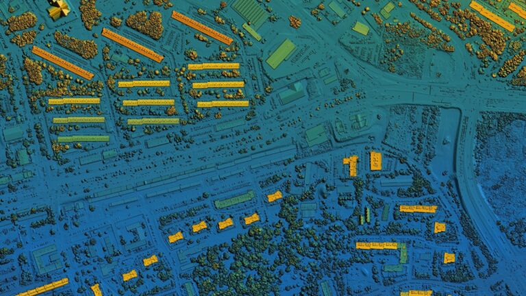
GIS platforms, especially when combined with remote sensors, save valuable time in gathering land-use and environmental data. By using images captured from a distance, urban planners can swiftly identify existing land use and track changes across the entire city. These images serve a dual purpose, not only aiding in accurate data collection but also enabling the creation of captivating visual representations using 3D CAD models.
This integrated approach streamlines the process of information gathering, equipping urban planners with a comprehensive view of land-use dynamics and environmental shifts. As a result, informed decisions can be made efficiently, optimising urban development strategies and facilitating a more sustainable and visually engaging urban landscape.
Creating Land-Use Maps & Plans
Using GIS, urban planners swiftly make maps of the current city. Then, they use special techniques to imagine different future possibilities. This helps them plan and create a map of how the city might look and work in the future.
They aim for a smart map, good for the environment, and makes sense. This process is like looking into the future to decide how the city should grow and change. It helps planners make choices that will lead to a city that is well-planned, eco-friendly, and works well for everyone.
Understanding Socioeconomic & Environmental Data
GIS’s visual aspect simplifies the study of location-related info, such as social and environmental patterns. It allows for making special thematic maps that mix data and places to show connections and trends. Inside the GIS system, lots of data sets are stored.
People can mix them to make detailed pictures with hills, roads, thematic maps, and more. This helps find good spots and potential problems easily. So, using GIS, people can see maps that tell stories about how places work and how they might change. It is like having a valuable map that helps authorities understand where things fit and how they relate.
Land Suitability Inspection
GIS tools, such as map overlay, assist city planners in evaluating if the land is suitable for certain uses. They do this by checking different maps together. Using technology like remote sensing and special searches, planners can find places that need careful attention for the environment. When they compare how the land is used now with how it could be used, they can spot any clashes between nature and potential changes.
This helps them decide where new buildings or projects should go and where they might cause problems. So, with GIS, planners can make wise choices that balance the needs of the city and the environment. The application of this robust technology does not end at this. When it is synchronised with Satellite Data Analytics, the urban development authorities can keep a watchful eye on potential dangerous situations ranging from climate changes, natural disasters etc. This will be highly helpful for the inspectors to cope with tree root intrusion as well.
Obtain Success Utilising New-Age Technology
Since you have come across this blog article, you understand the importance of the utilisation of modern technology in development projects. However, when you purchase a software solution for your company, it is necessary to align the features of the system with your company’s requirements. Getting partnered with a reputed supplier is an ideal answer for this matter.