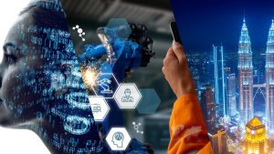
In a world full of enthusiasm for innovation and technology, the industrial aspect of a country is free to expand itself without barriers. It is absolutely a good thing that the business and technological worlds interconnect, targeting growth. However, with every step we take towards industrial expansion, one component becomes vulnerable to being destroyed. That one particular aspect is undoubtedly the environment. How can we strike the right balance between growth and environmental protection? This is where ‘Remote Sensing Technology’ enters the scenario.
How does remote sensing help the environment? Can we find the right balance when it comes to our business growth and surroundings? Come, let us explain everything about this in our article.
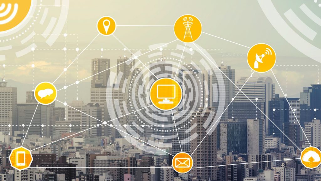
What is Remote Sensing Technology?

- This is a kind of technology that involves gathering information about the Earth’s surface without direct physical contact.
- How can it consolidate this large volume of essential data from the surroundings? That is simply because it works by using devices like satellites or aircraft equipped with sensors to capture data from a distance, as its name suggests.
- These sensors detect and record various types of energy, including visible light, infrared, and microwave radiation, emitted or reflected by objects on the Earth’s surface. The captured data is then processed and analysed to create images, maps, and other valuable information about the environment.
- For instance, remote sensing can monitor changes in land cover, assess crop health, or track weather patterns.
- The mechanism of remote sensing relies on the principle that different objects reflect or emit energy in unique ways. This capability is what allows relevant individuals to identify and interpret these patterns to understand the features and processes of the land that is being inspected.
- With other technologies expanding, there is an increasing enthusiasm for this technology. When employing remote sensing technology, scientists, policymakers, and environmentalists can gain insights into the land’s dynamic systems in real-time. This aids in tasks such as environmental monitoring, disaster management, and natural resource conservation.
- In fields like construction and transportation, this technology is used for better observation nowadays.
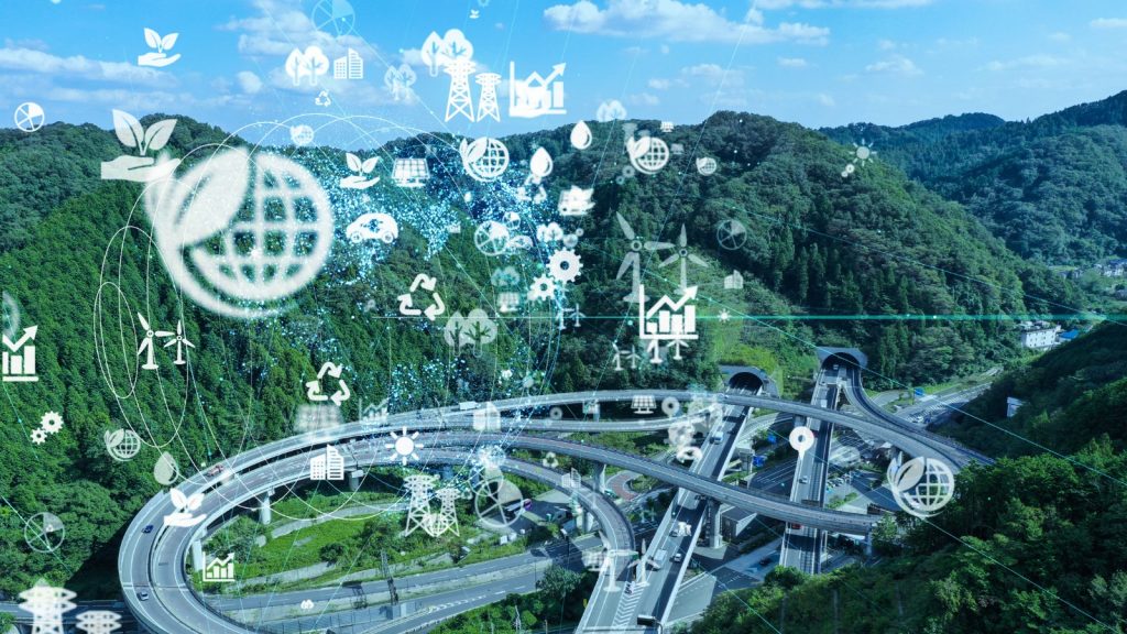
Main Ways Remote Sensing Benefits the Environment
Land Cover and Land Use Mapping
This remote sensing technology’s capabilities expand beyond traditional tools.
This provides precise and current data on how land is utilised and its surface characteristics.
This information aids in making informed decisions about land management, urban planning, and natural resource utilisation.
Remote sensing techniques, such as satellite imagery and aerial photography, capture images of Earth’s surface.
These images are then analysed to distinguish different land cover types, like forests, agriculture, or urban areas, and land use patterns, such as residential, commercial, or industrial zones.
It is common that the land is highly prone to changes over time. With the use of this technology, it is easy to identify changes that keep occurring, like deforestation, urban sprawl, etc.
On the other hand, remote sensing helps authorities plan sustainable land management strategies. For example, it can highlight areas prone to erosion or habitat loss, allowing for targeted conservation efforts.
This mechanism allows for a comprehensive understanding of land dynamics for the authorities. It also encourages the industrial world to balance development with environmental conservation effectively.
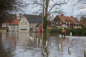
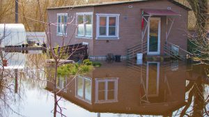
Water Resource Management
We know that about 71% of the earth’s surface is covered with water. However, if we take the usable water resources into consideration, they are unfortunately limited.
This is why the modern industrial landscape has been forced to pay attention to releasing toxins into waterways. However, water resource management is not something that we can take lightly, as it requires careful observation and analysis.
Remote sensing technology benefits the environment by aiding water resource management in various ways. In one way, it helps assess water quality, monitor water bodies, detect pollution sources, and map wetlands. We know that this technology works by utilising satellites or aircraft equipped with sensors to capture data about water-related parameters like temperature, turbidity, and chemical composition.
In another way, the collected information is then processed to generate maps and reports indicating the health of water bodies and potential sources of pollution.
As it powers the authorities to monitor such changes over time, remote sensing allows them to identify areas at risk of contamination or depletion. This guides effective water resource management strategies.
Let us explain this with an example. It can detect harmful algal blooms in lakes or trace pollutants in rivers, which suggests timely interventions to protect aquatic ecosystems and ensure safe drinking water supplies.
This is like two sides of the same coin. In one way, it helps preserve water resources. In another way, it balances out the sustainability and smooth functioning of industrial processes.
Agricultural Monitoring
Agriculture is the heart of a country and the livelihood of its people. Without this, there would be no food on our tables.
This is why the authorities pay attention to keeping this industry away from its potential burden. In that sense, remote sensing technology provides valuable assistance to farmers and agricultural authorities.
How is this made possible? As this includes satellites or specialised aircraft equipped with sensors, remote sensing captures data on crop health, yield estimation, irrigation optimisation, and the detection of pest infestations or diseases.
This mechanism works by analysing the reflected or emitted electromagnetic radiation from crops, which indicates their health and growth status. After interpreting this data through the associated technologies like the Internet of Things (IoT) and Data Analytics, farmers can make informed decisions regarding crop management practices. This can range from adjusting fertiliser application to implementing targeted pest control measures, etc.
On the other hand, agricultural authorities can utilise this information for policy-making and resource allocation to support sustainable farming practices and enhance food security initiatives.
It is evident that remote sensing technology contributes to a healthier and more sustainable food system, all while keeping the industrial sustainability promise alive as much as it can.
Air Quality Assessment
Industrial zones are number one on the list of areas that have the maximum amount of air pollution in the world. Air pollution happens when factories, mines, and transportation release toxic substances into the air. These pollutants can cause some serious health issues, such as respiratory diseases, cancer, decreased lung function, asthma, etc. We should not forget that they can also be harmful to the environment, which will cause acid rain and climate change.
Now let us elaborate on how the latter helps the environment by safeguarding the air. Using satellites and specialised sensors, remote sensing gathers data on various pollutants in the atmosphere, such as particulate matter, nitrogen dioxide, and ozone.
When analysing this data, scientists and governments can track pollution levels, identify sources of contamination, and evaluate the effectiveness of air quality management strategies. This method makes it possible to take prompt action to reduce pollution and safeguard public health from breathing problems and other negative impacts of low air quality.
Also, data from remote sensing helps to understand the spatial and geographical distribution of pollutants, which suggests focused responses in the regions where pollution is most severe.
Safeguarding Environments with Remote Sensing Technology
The whole world should gather around protecting the environment, just as we gather around profitability and growth. Safeguarding our nature and surroundings starts with one tiny step. This will lead to the healing of the entire earth one day. This is why you should make intelligent decisions when purchasing your industrial tools. If you hold hands with experts in the industry, it will be easy to balance technology with sustainability.