Walking away from traditional methods, farmers nowadays have started utilising sophisticated agriculture technology. The main reason for this huge movement is that when they are implementing new-era technology in agriculture, they can save time and money while expanding their efforts smoothly. That is where the necessity for Geographic Information Systems or GIS technology steps into the scenario. Because crops are location-based, this makes an extremely relevant tool for farmers.
The power to readily collect and analyse farmland data is one of many reasons why GIS is so beneficial in agriculture. From field machinery on the ground and drones to satellites in the sky, advanced technology has been utilised to collect GIS agriculture data which ultimately will assist in making a variety of decisions upon the rising demands for agricultural products. In this article, let us walk you through how GIS can optimise the agriculture industry.
What Exactly is GIS Technology?
It is a computer-based tool used to store, visualise, analyse, and interpret geographic data. Geographic data identifies the geographic features and locations through the advanced software employed by it.
What is the geographic data shown by GIS? Basically, it encompasses anything that can be mapped and is connected to a specific location on the globe. For instance, geographical data includes things like locations, national borders, and highways. If put in simple words, this GIS technology is a fusion of software and hardware. Therefore the data captured through other implemented technology such as GPS, drones, and satellites are monitored, analysed, and mapped by GIS which leads to the people who utilise it having an extended understanding of the areas or locations they intend to monitor. It is a visible fact that GIS makes it easy for users to make geographical data-driven decisions through the powerful insights it provides.
Top 3 GIS Interconnected Equipments that Optimise Agricultural Efforts
Sensors
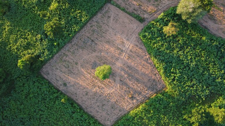
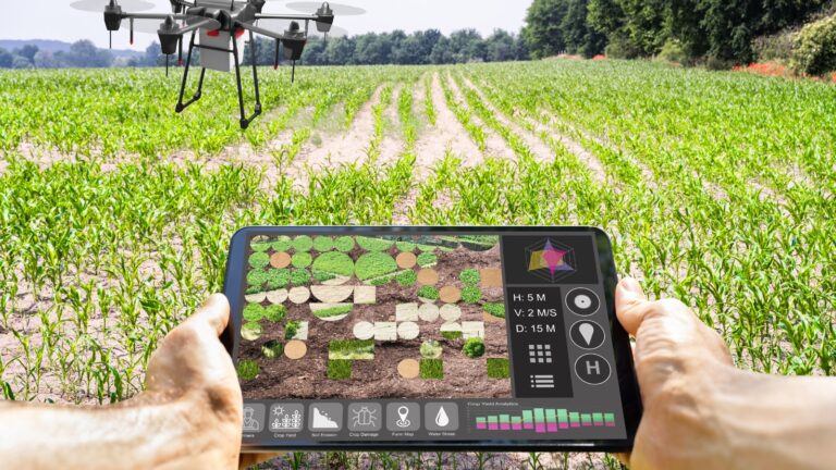
The exceptional coupling of remote sensing and GIS technology has changed data gathering, analysis, and decision-making processes. Various sensors, such as satellites, drones, and aerial platforms are used in remote sensing to obtain data about the Earth’s surface. GIS systems then embrace this data, which also contains images and other geographic data. Professionals can understand spatial correlations, patterns, and trends owing to GIS technology, which enables the storing, analysing, and visualisation of this data.
Some of the complex environmental requirements varying from land use, agriculture, disaster response, and urban planning can be monitored in detail remotely through this excellent integration of GIS and Sensors. When it comes to the implementation in the field of agriculture, remote sensing is a powerful key to identifying the possible threats and some other information regarding the land.
GPS
Through the combination of GPS and GIS, people can accurately determine the position of any location on Earth. When it comes to agriculture, GPS and GIS integration lets farmers collect real-time data which can lead to precise decision-making. In other words, farmers can boost the effectiveness of resource utilisation by using technology to accurately map out where to use certain resources on a given farm. The analysis of crop kinds, elevations, field boundaries, irrigation systems, etc. is made easier with the use of GPS-enabled field mapping.
Machinery
GIS agricultural machinery sensors enhance the data obtained from the above gathered by satellites with the ground inputs. Farmers are able to assess crop yield and quality through the use of GPS tracking devices in harvesters, irrigation systems, and sowing equipment. For instance, farmers can simply check the amount of moisture or chlorophyll at a given spot in real-time. Based on the data they gather, certain cutting-edge agricultural devices can perform detached steps, while others are utilised to support GIS analysis. Plus, the farmers can use the combination of machines and GIS to be precise on the application patterns of fertilisers and pesticides and it enables them to decide on the required period.
Top Ways GIS Optimises Agriculture Industry
Being Precise on Requirements
Precision agriculture is one of the main benefits of utilising GIS technology. For the purpose of helping users of it make informed decisions, this application offers precise maps of crop statistics and vegetation production. Vegetation levels in the field or any of its regions could be determined using GIS tools for agriculture.
Through the machines that are employed, farmers can subsequently use this information to alter the quantity of seeds, nutrients, herbicides, and fertiliser for each plot by floating the acquired data to the appropriate machines. Using data from previous seasons, GIS Monitoring enables farmers to construct maps of their farms’ production. Farmers can distinguish between profitable and unproductive areas with the use of technology, and they can fertilise the latter with the resources they have.
Soil and Vegetation Index Mapping
The development of soil index maps and vegetation indexes like the Normalised Difference Vegetation Index (NDVI) is made possible by satellite sensors, which enable effective soil and crop analysis. GIS mapping for agriculture enables field management and monitoring, resulting in effective agricultural production.
Farmers can evaluate how many factors affect production by comparing field vegetation across a range of dates or using other indexes. With the help of the split view function provided by GIS, farmers can compare the performance of two separate metrics on the same day or evaluate both the present field conditions and historical data from earlier periods. This all-encompassing strategy enables data-driven decision-making for improved farming practices.
Crop Health Monitoring
When the field of agriculture is concerned, it is always better to focus on prevention rather than curing. That is why crop health is important for the farmers. GIS technology can be utilised to detect possible threats to the crops and inspect any small change which has just started spreading. Through satellite imagery, drones, and ground-based sensors it is highly possible to do crop health mapping comprehensively.
The insights farmers receive from this software are valuable when identifying the threats to crop health and stopping them from widely spreading. Early detection which is possible through GIS makes the space for them to take prompt corrective actions and provide nutrition for their crops.
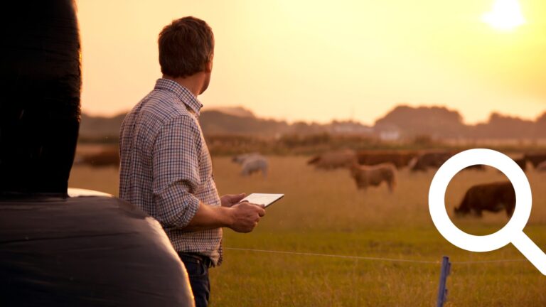
Animal Movement Tracking
When it comes to agriculture, animal husbandry plays a crucial role. Unlike crops, these animals tend to move around a widespread location which makes it challenging for the farmers to monitor their behaviour.
GPS technology provides a convenient way to track livestock as the best solution as it can show the farmers in which location their animals are roaming, and what type of threats they are about to face due to geographic limitations such as rivers, slopes, etc. With the employment of GIS, the livestock of the farms are protected now.
Meeting Future Food Demands Utilising New Technology
As the demand for food expands regularly, it is necessary to fulfil the requirements of the future generations through agriculture. That is why the necessity for the utilisation of advanced technology like GIS needs to be introduced to this industry. As you have read in the article, there are lots of operations that are usually known as time-consuming, can be streamlined and organised with them. Also, farmers no longer need to stay away from stepping into the rapid food competition as they can not match the market demand with their agricultural productions. With GIS technology, both time and money will be saved.