When you have one powerful tool, it is enough for you to cover various aspects of the project you are monitoring. But when you combine the power of the two tools together, the visibility it gives is just unimaginable! This is exactly what Geographic Information Systems (GIS) and Building Information Modelling (BIM) technology do when combined for one objective.
In this article, we will discover how the synergy of GIS and BIM revolutionises the world of construction and the benefits this robust integration offers.
What is GIS?
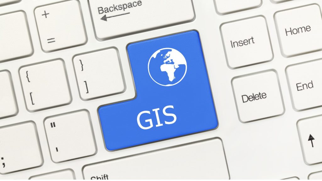
- This technology is a powerful tool used to capture, store, analyse, and visualise spatial data related to the Earth’s surface. This is basically scanning all the geodata and offering powerful insights that you cannot see with a naked eye.
- GIS integrates various types of geographical data, such as maps, satellite imagery, and survey data, into a digital framework. Through sophisticated software, GIS allows users to manipulate and analyse this data to gain insights into spatial patterns, relationships, and trends.
- It helps users to create maps in the first place. Then it can perform spatial analysis and make informed decisions across various industries. This technology is highly important in industries including urban planning, environmental management, transportation, and public health.
- In the purest sense of the word, GIS technology plays a crucial role in understanding complex spatial phenomena, which leads to wise decision-making processes. The latter is also the ideal tool to address real-world challenges related to spatial components.
What is BIM?

- This is a digital representation of the physical and functional characteristics of buildings and infrastructure.
- BIM carries geometry, spatial relationships, geographic information, and the properties of building components, and this helps architects, engineers, and construction professionals collaboratively design, visualise, simulate, and manage buildings and infrastructure throughout their entire lifecycle.
- The mechanism of BIM involves creating and managing digital representations of the physical and functional characteristics of places.
- This includes 3D models containing information such as materials, construction details, and spatial relationships.
- BIM software aids better decision-making, enhanced collaboration, and increased efficiency in the design, construction, and operation of structures by making it possible to edit these models, analyse data, simulate performance, and produce documentation.
Key Benefits of GIS and BIM Integration

Cost Savings
What is that one thing the entire development world expects at its core? That is the maximum ROI. Do you agree? How can you make this a reality when your spending is quite heavy? This is where GIS and BIM integration are vital.
This leads to substantial cost savings through several mechanisms. Firstly, by combining GIS data on site conditions, environmental factors, and infrastructure with BIM models detailing building designs and components, construction companies can optimise project planning.
This includes selecting optimal site locations, considering terrain and environmental impacts, and minimising potential risks, thereby reducing costly errors.
Another fact is that GIS-BIM integration clears the way for better resource allocation by providing insights into material availability, transportation routes, and site logistics. This permits more efficient use of resources and reduces waste.
GIS-BIM integration also promotes stakeholder cooperation, which improves decision-making processes, speeds up problem-solving, and reduces rework.
Development companies are able to achieve substantial cost reductions throughout the project lifecycle by streamlining project timeframes, minimising mistakes and rework, and ultimately increasing profitability and industry competitiveness.
Enhanced Project Visualisation
The synergy of these two technologies provides you with a comprehensive visual representation of both the built environment and its surrounding geography. As you can see, this is leading to a better understanding and analysis of site conditions.
Let us explain how this happens. GIS data offers detailed information about the surrounding terrain, infrastructure, and environmental features, while BIM models provide intricate representations of building designs and components. If you combine these two components, you will be able to gain a full-scale view of the project site for sure. It helps you visualise how the proposed structures interact with the surrounding landscape.
This improved project visualisation helps early in the planning stage to detect possible obstacles like uneven terrain or environmental limits. Likewise, the ability to offer simple and easy-to-understand project plan visualisations promotes enhanced stakeholder communication and decision-making as well as cooperation throughout the building phase.
Improved Spatial Analysis
You may already use advanced tools to get this analysis. But you cannot deny the fact that this combination of GIS and BIM is unparalleled when it comes to spatial analysis! When you conduct such advanced analysis, It helps enhance project planning and decision-making in parallel.
As we stated before, by combining these two aspects, construction teams can optimise site selection, identify potential risks, and improve resource allocation without overlooking any important facts.
This integration makes it possible to have a thorough awareness of the physical environment around the construction site, which helps with decision-making about the layout of the site, the orientation of the buildings, and the positioning of the infrastructure.
The identification of any risks or limitations, such as geological characteristics or environmental sensitivity, that could affect building activities is another benefit of advanced spatial analysis.
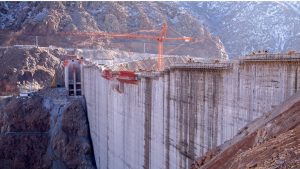
Better Site Management
Did you know that the integration of GIS and BIM backs up the entire project’s success as it offers better site management capabilities?
How is it possible? Integrated GIS and BIM systems encourage real-time monitoring of construction activities and site conditions in the first place. Providing project managers with comprehensive insights into project progress and challenges is also possible with this integration capacity.
Since they can keep monitoring, project managers can promptly identify and address issues such as delays, deviations from plans, or safety concerns. As a result of this real-time insight, proactive decision-making is possible to maximise processes, distribute resources effectively, and reduce risks. Every bit of this eventually adds to the overall efficiency of the project.
Enhanced Asset Management
This integration is an outstanding approach to enhancing asset management, as it links spatial and building data to make decisions.
When integrating GIS and BIM data, development parties can establish comprehensive asset management systems that track the entire lifecycle of built assets, from design and construction to operation and maintenance.
Due to this integration, it is easier to create Digital Twin, which is an accurate virtual representation of physical assets that encourages real-time monitoring and analysis. With these systems in place, constructors can allocate resources more wisely and save money by making more informed decisions about asset performance and maintenance schedules.
Additionally, the ability to access historical data and predictive analytics enables proactive maintenance strategies, prolonging asset lifespans and minimising downtime. Integration is what gives you an extra arm to look into the weak points of the project and lets you make necessary adjustments before they impact the entire completion and success of the development project.
Linking GIS and BIM through a Full-Scale Technological Arrow

You understand that GIS and BIM are two different models that cover the geological aspect of the site or the development area. The capacity of these two technologies becomes double when they are integrated into one system. However, you need to consult an industry expert before making any decision about purchasing, as the whole successful outcome depends on the reliability of the service provider.