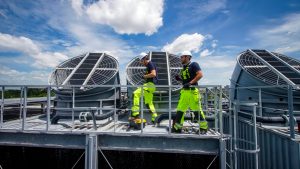
According to reports, Australia is enriched with around 53,000 bridges. Building a bridge is one important fact that shapes the development of the country. However, maintaining its quality while engaging in respective project processings and post-construction should receive massive weight undoubtedly. From Sydney Harbor to Swan River, every bridge must be monitored and safeguarded to receive the best outcome from these development projects.
But why has the satellite been in the spotlight whenever there is a discussion on bridge building? What is the connection between Satellite technology and bridge construction? Let us fill you with all the knowledge about that in our latest blog article.
The Employment of Satellite Technology

- Satellite imagery can help with site selection and planning.
- It offers precise GPS data for accurate surveying, helping establish control points and monitor construction alignment.
- Regular satellite images enable remote monitoring of construction activities and project milestones.
- Satellites help track changes in vegetation, water quality, and habitats, aiding in environmental impact assessment.
- The data provides weather forecasts that are crucial for planning construction activities.
3 Main Challenges Faced in Bridge Construction

Possible Structural Failures
The biggest challenge in building bridges is known as its structural failure. During engineering operations, factors including severe loads, environmental stresses, and insufficient upkeep continuously put pressure on a bridge’s foundational strength. Such errors can have negative effects that put lives in danger and disrupt transportation systems.
Nowadays, responsible authorities use sophisticated design and inspection procedures together with cutting-edge building materials and construction methods to reduce this danger. Regular maintenance and monitoring is the key to ensuring the long-term structural health of bridges.
Impact of Site Condition and Geology
When it comes to bridges, it is crucial to have a thorough grasp of the local geology and ecosystem before beginning its building. It is evident that those critical elements, including the kind of soil, bedrock depth, and water table level, all have a significant impact on the complex foundation design and building techniques for the bridge.
This is why construction companies have to perform thorough site studies. One of the major aspects to inspect is its detailed soil nature testing. It is the company’s responsibility to ensure that the bridge can survive the difficulties presented by the particular site circumstances. Some of the measurements are needed to determine the structural stability and long-term durability of the bridge, which can not be gathered manually.
Environmental Considerations
You know that bridges regularly cross waterways, sensitive ecosystems, and sources of water. That is how it poses the risk of serious environmental damage. The construction authorities are required to adhere strictly to environmental standards and apply erosion control measures when it comes to Australian law. They are required to use such techniques that can help reduce disruptions to terrestrial and aquatic environments in order to protect the environmental balance.
Furthermore, it is common in Australia that bridge construction often requires obtaining permits and approvals from relevant regulatory agencies. This is because it is essential to ensure the project aligns with established environmental standards and safeguards the delicate ecological balance of the surrounding areas.
Exploring the Role of Satellite Technology in Bridge Construction

Remote Site Monitoring
This owns the top position when it comes to key benefits of satellite technology in bridge construction. It clearly revolutionises how companies oversee and manage their projects. It involves gathering data and photos from the building site using satellites in space. Project managers could closely monitor progress, spot possible problems, and guarantee timeline adherence thanks to this real-time information through its remote monitoring.
On the other hand, how can we forget it reduces the need to visit sites physically? Yes, site monitoring eliminates the need for regular on-site visits, which saves time and money for the company. Then, it improves safety by quickly spotting potential dangers or deviations from the original plan. With satellite technology in use, engineers and authorities can completely rely on the information that they can receive through them. It enhances the decision-making capabilities to another level.
Providing Detailed Maps
When satellite technology is coupled with geographic information systems (GIS), it has the capacity to offer an invaluable resource for comprehensive project planning in bridge construction. This fusion of systems provides very precise maps and geographic information by utilising the data received from satellites circling the Earth. This information is crucial for choosing the best route, designing the alignment, and spotting any construction roadblocks early on in the process of building a bridge.
How can this be done so conveniently? GIS enables engineers and planners to analyse terrain, environmental conditions, and infrastructure networks with precision as the outcome. Obviously, the result is facilitating informed decision-making!
Tracking Environmental Conditions Around Sites
As we mentioned above, sustainability receives a top priority when it comes to modern-day construction projects. So, how can the latter help with those initiatives? They have the capacity to closely observe changes in several environmental factors, including the amount of vegetation present, the quality of the water, and the condition of wildlife habitats. Construction teams have access to this crucial information from this ongoing monitoring as a result.
This empowerment allows them to take proactive steps to reduce their ecological footprint. If you have noticed, this is the best way to look into the essential ecological aspects and minimise negative effects from the construction. This technology extends its helping hand to the constructors to ensure compliance with strict environmental requirements in Australia by quickly recognising possible environmental disturbances.
Ensure Bridge Alignment
Aligning bridges is not as easy a task as it seems. Do you agree? But the best thing is that Global Navigation Satellite Systems (GNSS), such as GPS and GLONASS, provide highly accurate positioning and geodetic measurements. Engineers use these systems combined with satellites, to establish control points and monitor the alignment of bridge components without anything going wrong.
When it is implemented, the construction teams can identify any small variations from the design requirements by continuously monitoring the positions of essential components, such as bridge support structures. This early alignment problem detection is helpful in prompt corrections, ensuring that the bridge is constructed precisely and lowering the chance of structural problems.
Remote Progress Monitoring
This state-of-the-art technology serves as a ‘must-have’ for project managers in the field of bridge construction. How is it possible? Well, it is not that complex due to its advanced integration. The latter can routinely take high-resolution shots of the worksite through immense distances.
As these images offer a comprehensive view of the ongoing construction progress from above, it is an excellent way to inspect the project progress even without physically visiting the site. it ensures uninterrupted inspection of the project’s development. A thorough understanding helps them to promptly identify delays in the schedule.
Exploring New Depths of Development with New-Era Innovations

Although the development in today’s world is massive, there are certain challenges that can interrupt or delay the improvement. However, the solution to this lies in the hands of new technology. Why don’t you leverage its power when you can achieve something big with it? This is something you should think about!