As one of the major branches of urban development and regional planning, land-use planning is something to gain attention from the authorities during the initial stages of the development process. If not taken care of, this can lead to many short-term and long-term obstacles. That is why the authorities need robust technology to determine how to utilise the land they have selected to get the optimal benefits.
In this article, we will explore the revolutionary employment of Geographic Information Systems (GIS) in the field of urbanisation or more specifically land-use planning.
Introducing GIS Technology

This technology is a comprehensive platform for collecting, storing, analysing, and visualising spatial data related to geographic locations on Earth’s surface. It combines geographical information, such as maps and satellite imagery, with attribute data to provide a holistic understanding of the environment.
GIS technology integrates seamlessly with various emerging technologies like IoT (Internet of Things), Digital Twin, satellite imagery, sensors, and even surveillance systems like CCTV. By connecting with IoT devices and sensors, GIS can gather real-time data on environmental conditions, traffic, weather, and more. This data can be integrated into a Digital Twin, a virtual replica of a physical environment, to simulate and analyse scenarios for better decision-making. On the other hand, Satellite imagery provides high-resolution geographic data, while GIS can enhance it with additional information. Nowadays businesses in the construction business started utilising this robust technology in their missions.
What is Land-Use Planning?
Land-use planning is a branch of urban planning and regional development. It encompasses the systematic process of allocating and organising land for various purposes within urban areas. It includes evaluating and planning how land could be used for residential, commercial, industrial, recreational, and environmental purposes while taking into consideration the demands of the community, infrastructure, transportation, and the environment.
The sole purpose of incorporating land-use planning into urban development projects is to create well-organised, sustainable, and livable urban environments that effectively cater to the needs of its citizens, businesses, and the surrounding regions. This ultimately defines the physical and functional aspects of urban spaces. This whole process includes zoning regulations, comprehensive plans, and spatial analysis.
How to Utilise GIS for Land-Use Planning

Environmental Impact Assessment
GIS technology is a valuable weapon when it comes to Environmental Impact Assessments (EIAs) in land-use planning. It allows relevant authorities to integrate spatial data, such as topography, soil types, vegetation, and water bodies, with attribute data on environmental factors like air quality, biodiversity, and pollution levels. As the software can overlay this information, it can model potential land-use scenarios and assess their impact on the environment.
The power of this solution is not limited to one aspect. Now with this technology in hand, authorities can identify sensitive areas and predict the ecological consequences of proposed developments. This leads to making informed decisions to minimise environmental damage. Plus, it aids in public engagement by creating visualisations that help stakeholders understand the potential impacts, fostering transparency and more sustainable land-use decisions.
Spatial Analysis
Another outstanding functionality of this technology empowers land-use planners is its ability to conduct sophisticated spatial analysis before embarking on any project. This enables the identification of optimal locations for different land uses, including residential, commercial, and industrial areas making data integration easier, and making it possible for planners to take important elements into account like accessibility to transportation networks, availability of necessary services, and adherence to environmental restrictions.
These are made easier now with this sophisticated software. GIS makes use of geospatial data to generate maps that emphasise locations most suited for certain uses while simultaneously accounting for geographic and infrastructure factors. This analytical strategy supports effective land use, encourages urban development that maximises accessibility, reduces environmental impact, and improves the overall usefulness and sustainability of urban places, eventually supporting the development of lively and well-planned communities.
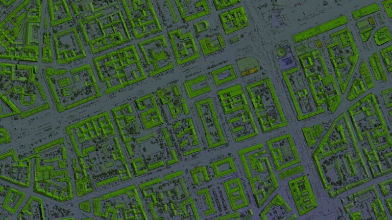
Zoning and Land Use Mapping
The cutting-edge capabilities of the latter make it a ‘must-have’ for urban planning. That is because this makes it easier to create detailed zoning and land-use maps as we mentioned before. Why are those maps so important? These comprehensive maps give insights into the spatial distribution of residential, commercial, industrial, and recreational zones while giving planners a dynamic visual picture of the existing land uses within a metropolitan region. As it is capable of placing prospective developments onto these maps, GIS makes it possible to create future development plans. Plus it helps with assuring compliance with zoning laws and land-use rules in Australia.
GIS capabilities extend their helping hand to urban planners to make informed decisions, optimise land allocation, and enhance land-use enforcement through spatial analysis. Ultimately we can witness that it encourages well-organised and sustainable urban development that caters to the evolving needs of communities. This technology backs up regulatory compliance initiatives too.
Suitability of Soil
As we mentioned above, GIS technology’s capabilities go beyond expectations when integrated with sensors. This powerful combination or integration plays an important role in assessing soil suitability for urban planning. How exactly does this occur? As the initiative progresses, Soil sensors collect real-time data on various soil properties such as moisture levels, pH, texture, and nutrient content. Planners are empowered to get important knowledge about soil quality and its suitability for particular land uses by combining this data with GIS and using it to geospatially analyse and map the data.
GIS can discover regions with soil conditions suitable for building, agriculture, or landscaping by combining sensor data with other geographic information such as land slope, proximity to water sources, and land cover. The alignment of land allocation with the soil’s suitability for the intended purpose is made possible by this integration as an outcome. Ultimately it helps in the informed decision-making process during urban planning.
Infrastructure Planning
Infrastructure planning receives the utmost importance when it comes to urban planning and regional development. GIS enters the scenario as a potent weapon by offering a comprehensive analysis of existing infrastructure elements, encompassing roads, utilities, and public services. Utilising these spatial analyses and data integration, GIS enables authorities to assess the spatial distribution and condition of these critical assets. This data-driven approach makes it easier to come to well-informed decisions, ensuring that infrastructure components are installed, maintained, and expanded in capacity in the best possible ways.
If further explained, GIS helps in identifying areas with increased demand, assessing the condition of existing assets, and predicting future requirements too. Another good thing about this technology is that it aids in the efficient allocation of resources and reduces congestion. Plus, this enhances overall connectivity and optimises the overall functionality of urban environments.
Flood Risk Assessment
This is one of the reasons that urban planning authorities should opt for GIS. Due to its robust integration capacity, this tool can collect data on topography, hydrology, historical flood events, and land-use patterns from the synchronised software. Then as a result it can accurately identify flood-prone zones within an urban area. This data is essential for making wise land-use planning decisions and creating efficient flood control strategies. Planners can adopt zoning laws to prevent growth in high-risk regions, allocate land strategically for flood retention basins, and provide infrastructure like levees and stormwater management systems.
It is quite visible that GIS empowers urban planners and disaster management authorities to proactively reduce the potential damage and disruption caused by floods. It also aids in safeguarding both the environment and the well-being of urban communities.
Expanding Capabilities with New-Era Innovation

If the development is concerned, there are many aspects you need to take care of. The best way to expand your capabilities towards decision-making is by adapting innovations through technology. However, doing your research before coming to purchasing decisions is rather important. Not every technology can serve you the best results. That is why you need to collaborate with an industry expert.