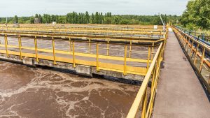
Geographic Information Systems (GIS) is a digital technology that creates, manages and provides a data map. In other words, GIS can capture, store, and display data related to assets on a digital map that includes descriptions. While this is used in various industries, including for assessing the vegetation in the agricultural sector, it is popularly known among road asset managers who use it to visualise assets in the transportation sector. This includes pavements, highways, bridges and more. Through this, they can utilise the power of GIS to locate any asset and monitor their health condition, consider which route would be the best for maintenance, and engineers can even try out different designing methods. It is, in essence, a technology that helps managers to compare locations and understand spatial or linear patterns and relationships.
How Does It Work?
GIS is a combination of hardware and software applications. It integrates a mix of photographic, cartographic, and digital data. It also incorporates data in remote sensors, spreadsheets and satellites. Each data type acts as a layer of information contributing to considering the suitability of constructing an asset. For instance, cartographic data helps managers assess the physical landscape and its suitability to build a specific asset. At the same time, information on demography which can be inserted through spreadsheets, may help managers to consider which roads require the highest priority based on the number of people who use them. GIS combines all these different types of information and showcases it according to their relevance.
GIS does not simply showcase a road asset on a map. Since it processes a large number of data, all of its layers help asset managers to gain helpful insight. This includes information relating to public places a road may border. For example, does the road lead to or pass by a school or hospital? It also allows managers to assess the different routes a highway network is connected to. In other words, it provides a comprehensive bird’s eye view of everything in the transport sector, going beyond simply focusing on the asset individually.
Four Ways GIS Is Helping Road Managers
Out of the industry 4.0 technologies introduced in the past yeast, GIS has been slowly blooming in the transportation sector. However, with GIS’s multiple benefits, it is clear that GIS is a not-to-be-missed technology today. Here are four ways GIS is helping road managers to perform their functions better whilst reducing overall costs and resources:
Prioritising Maintenance Based on a Criticality Tagging System
Roads, highways, bridges and other assets do not promise lifelong sustenance even when a robust infrastructure is in place. Road assets need to be maintained to ensure that they can meet the industry’s standards and guarantee public safety. This is why it is crucial to carry out routine checkups on every road asset. At one point, a team had to be dispatched to assess the health of assets. As this became time-consuming, road managers started to use IIoT sensors, Artificial Intelligence (AI), Machine Learning (ML) and a range of other innovative technologies to automate it. GIS uses all the data from such devices to assess which assets are in critical condition. Good technology vendors will integrate the predictive and prescriptive analytical tools to detect any anomalies that could occur in the future. This can forewarn managers of breakdowns that may occur. Using these insights, GIS reflects the need for such assets to be the maintenance in its digital map hierarchically. In other words, it will showcase which asset requires the highest priority and tags maintenance accordingly. This way, a road manager can gain an overview of the maintenance that is needed to be carried out.
Carrying Out Data-Driven Analysis Based on Your Needs
GIS can process enormous amounts of data easily and present important information and insights on an interactive smart screen. However, it may be pointless if all GIS did was simply give all the information it receives through other devices. It would result in the map being overcrowded and require humans to do the vital work of dissecting it, analysing it and making a decision. GIS has been recognised as a perfect solution for road managers because it does not rely on human experts or specialists. All data-driven insights are drawn with the help of AI and ML technologies which managers can rely on to take prompt action to rectify any defects. Thus, GIS presents only the information that the manager requires. For instance, if the manager wants to view asset conditions, it will only provide details about them. Suppose, on the other hand, the manager needs to choose between repairing two critical assets due to a lack of financial resources. In that case, the system can provide insights on the asset not purely based on the asset condition but by considering practical factors relaitng to how often the public uses it. Additionally, GIS can provide accident analysis reports with the help of CCTVs and utilise data to help asset managers find the best route for maintenance.
Implementing a Contingency Plan for Natural Disasters
GIS can detect weather patterns and conditions. Hence, GIS will monitor the changing climate and reflect it on the map where a natural disaster is imminent. It will warn road managers with ample time in advance of the expected magnitude of the disaster and the areas that will be affected. This is a great way to take measures to protect the public and consider any plans that can be implemented to safeguard assets. Hence, where evacuation is required, asset managers can share the insights received by GIS to local authorities. Engineers can also use this information to carry out simulations when designing assets. Incorporating that data into something like digital twins, they can test out the robust nature of the asset and ensure that they are built to withstand such events.
Traffic Modeling and Reducing Your Carbon Footprint
Traffic has been a constant problem in developing and developed countries. It can be a massive inconvenience to drivers on the road and cause road accidents. Increased congestion on the road has also resulted in an increased number of CO2 emissions being released into the atmosphere. This, in turn, also means that a person’s carbon footprint increases. Instead of completely considering public transportation as an option to lead a carbon-free life or transitioning to green energy vehicles, there are additional ways that the environment can be protected. This includes constructing sustainable road networks. GIS is used for traffic modelling by adopting functional road models. The roadmap from GIS can be used to create a 4D model of large-scale road networks, which can after be used to carry out real-time traffic simulation. Asset managers can use virtual and augmented reality capabilities to run autonomous vehicle navigation and test new road features for traffic simulations. This includes the addition of highways, merge zones, intersections and more. Once a sustainable infrastructure is finalised, GIS helps asset managers enact and monitor it in real time.
A Mandatory Technology for Road Managers Today
Having an aerial view of all your assets makes a big difference. A powerful technology like GIS allows you to monitor each asset in your entire country or state in one go. Avoid splurging money on multiple devices and invest smartly by doing your research on a reputable brand that provides a compact solution. Tigernix equips the most demanding and advanced industry 4.0 technologies to help its customers gain faster ROI. Utility managers relying on the public fund to execute their services should therefore consider GIS a mandatory technology that can efficiently help road asset managers carry out their roles.