As it is estimated, natural disasters cost the Australian economy $38 billion per year on average. If the right technologies are implemented this loss can be reduced drastically. That is why you need some advanced technologies like satellite data analytics to prevent natural disasters. They can not be stopped but if predicted earlier, the loss of lives and properties can undoubtedly be decreased. Through the high-tech capabilities of satellite technology, companies, and government authorities can conveniently inspect irregularities in the climate or vulnerable areas to natural disasters.
In this article, we will explore the best features of satellite data analytics and the best way it could be utilised to prevent natural disasters.
What is Satellite Data Analytics Technology?
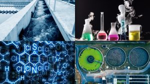
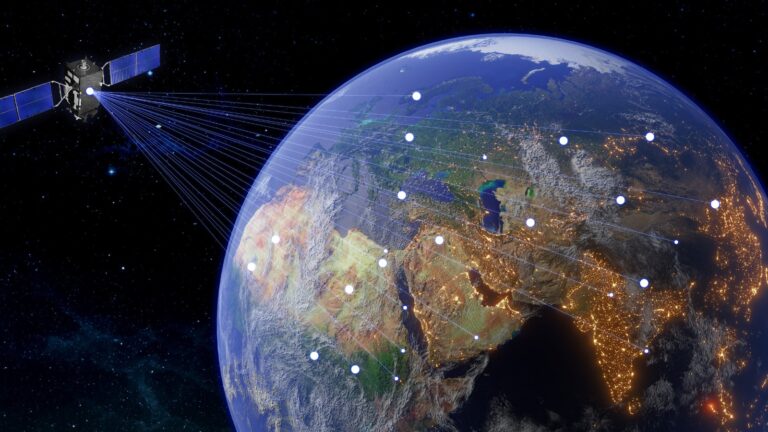
It is referred to as an advanced technology that has the ability to create a process of collecting, analysing, and providing insights gathered through satellites orbiting the Earth. Images, thermal readings, and remote sensing data can be collected covering a vast geographical area which can not be done manually. The sophisticated algorithms and the high-tech data processing capacities make this extracting meaningful information through revealing patterns, trends, and any small change that can happen on the surface of the earth.
When it comes to the employment of this technology, satellite data analytics are being utilised mostly for water plant facilities, coastal protection authorities, government agencies, and any business related to climate and the environment. When utilising satellites, the authorities can take preventive measures based on the data received through satellite data analytics which is an indispensable technology in today’s data-driven world.
What Features of Satellite Data Analytics Optimise Natural Disaster Management?
There are three main features in the technology of satellite data analytics. Those are remote sensing, satellite imagery, and SD GIS models. In the section below we will explain how it optimised natural disaster management.
Remote Sensing
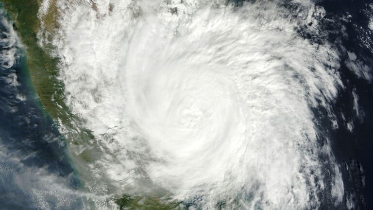
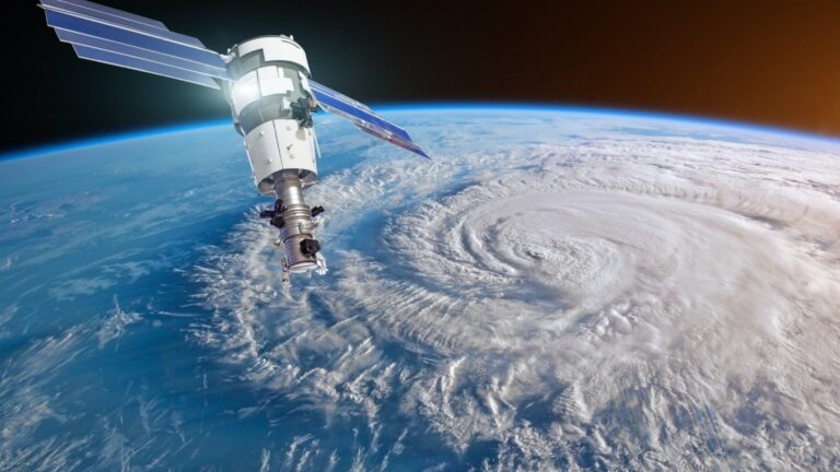
The main component of satellite data analytics that improves the response to natural disasters is remote sensing. Satellites make it possible to monitor and analyse disaster-prone areas in real time since they can gather useful data from far locations. Authorities can quickly and precisely analyse the impact of a disaster by using remote sensing to follow weather patterns, spot environmental changes, and track weather trends.
Early detection of natural disasters, sending timely alerts to the relevant parties, and planning response collaboratively are the areas remote sensing makes it easy when it comes to natural disaster management. Though there are some geographical areas humans can not reach, they can be inspected through these remote sensing techniques and this capability empowers the authorities who handle disaster management. Prediction of the areas to be affected, potential environmental threats, and damaged parts of assets such as water plant facilities and water dams utilising remote sensing. When bolstering disaster preparations, minimising risks, and improving overall efficiency, remote sensing empowers the whole procedure.
Satellite Imagery
This feature is what makes satellite technology unique. Through the utilisation of high-resolution images taken from orbit, satellites provide vital visual data for disaster monitoring and evaluation. In the case of a natural disaster, satellite imagery enables speedy damage assessment and assists in precisely pinpointing affected locations. The crisis management teams can organise relief activities, allocate resources more wisely, and make informed decisions thanks to this real-time visual data.
Also, the implementation of satellite imaging aids in the monitoring of environmental changes, the tracking of weather patterns, and the assessment of possible dangers, allowing for the early identification and forecasting of disasters. Harnessing satellite imagery’s capability improves disaster planning, response, and recovery, making it a crucial tool for protecting populations and lessening the effects of natural disasters.
3D GIS Models
Deployment of 3D Geographic Information System, or GIS, models is a crucial aspect of satellite data analytics that significantly enhances the management of natural catastrophes. Due to the use of satellite imagery and remote sensing data, 3D GIS models accurately represent the surface and topography of the Earth.
These models provide a multidimensional overview of regions vulnerable to disasters in the context of disaster management, assisting in risk assessment and vulnerability analysis. Authorities can see prospective scenarios, plan evacuation routes, and evaluate the effects of disasters on infrastructure and communities due to the dynamic and immersive nature of 3D GIS models. Utilising 3D GIS models improves decision-making, disaster planning, and response tactics, enabling authorities to actively reduce risks and safeguard people and property in the event of natural disasters.
Top Ways Satellite Data Analytics Optimise Natural Disaster Management
Advance Alerting
As we mentioned above, this technology is enriched with the capacity to inform relevant parties by sending emergency alerts to their communication channels once it detects a threat is coming in the near future. For example, in the case of hurricanes, tsunamis, storms, or floods that are about to occur, the system integrated into the satellite analytics, sends these automatic messages to the authorities giving time to take necessary actions.
Detecting Changes in the Environment
Latter has the ability to detect any small change in the environment which will help the authorities to take prevention actions. If deforestation and land degradation occurred, the satellite captures the change at once and processes this data through its advanced analytics and makes it possible for the responsible parties to isolate those areas by removing civilians.
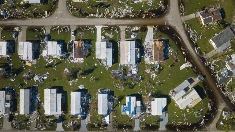
Rapid Damage Assessment
We can not stop natural disasters from occurring, but with the utilisation of satellite technology, we can reduce the damage to some extent. Through the implementation of this technology, authorities can have a thorough understanding of the damaged areas, properties, and etc in real-time as it can assess the rapid damage within a short time.
Remote Monitoring for Inaccessible Areas
There are some areas that can not be reached by humans or drones. For example, the mountains of the Andes are extremely difficult to detect through most of the technology. However, when the satellite is utilised, it has a high possibility that each space on the earth can be detected through it. This will be very effective for volcano inspection and in the event of plane crashes due to extreme weather conditions.
Mapping Vulnerable Areas
Having a detailed map is very important for natural disaster management efforts. It allows the authorities to identify disaster-prone locations in real time. With the mapping abilities of this technology, identifying vulnerable areas, and separating them into high-risked, medium-risk, and low-risk areas will be beneficial in allocating manpower to isolate these places.
Agricultural Monitoring
When it comes to natural disasters, agriculture is the industry that gets affected by it the most. Even possible floods and droughts are inspected through satellites and farmers can be informed in advance.
Coastal Zone Monitoring
Utilising satellite technology to detect erosion and changes in sea levels is the most common application of it over the years. Weather conditions can be monitored and predict future threats in advance and according to those predictions, the shipping operations could be scheduled or cancelled. Plus, certain changes in the sea can be inspected through satellites before disasters like tsunamis occur.
Boosting Natural Disaster Management Capabilities with New-Era Technology
Though natural disasters can not be fully stopped or prevented by humans, predicting them in advance, isolates people from vulnerable areas, and planning how the disaster management goes needs to receive more weight. The more the earth is prone to environmental damage, the more we will experience these kinds of natural disasters. That is where the necessity for new-era technology such as satellite data analytics should be given more importance. If a disaster can not be stopped, then we should try to reduce the damage. That is the sole purpose of natural disaster management.