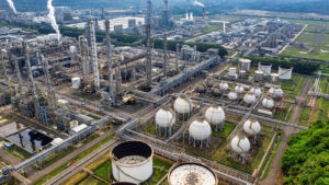
Satellite technologies are positioned out of space and are designed to cover particular wavelength ranges. It uses remote sensing, atmospheric sounding and takes aerial snapshots, all of which are used for weather forecasting, television and telecommunication, geo-positioning and more. Certain countries use this technology to ensure water quality management. However, it is not majorly used by asset-centric companies in Australia. Considering that climate change has resulted in Australia facing an increased risk of water scarcity at an alarming rate, the government should consider implementing satellite technology in its state-owned organisations that provide services in the water utility sector. This would particularly benefit water or wastewater asset management corporations to ensure water quality management.
How Satellite Technologies Play a Role in Water Quality Management
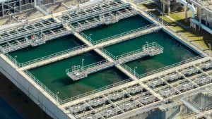
Water quality management has been an issue for a long time. While various technologies have emerged throughout the years to improve it, incorporating satellite technologies brings many advantages that were not available to water utility managers before. Here are five ways how satellite technologies play a crucial role in water quality management.
Get Instant Updates on Water Systems as Large as 30,000 or More Kilometres
Water utility managers can collect enormous amounts of data for an entire town or city spanning as far as 30,000km or more. Throughout the day, water quality measures such as chlorophyll, temperature, light attenuation, organic matter, and turbidity can be monitored in all lakes, rivers or any freshwater body. Through remote sensing data and high-pixel images captured by Landsat 8, utility managers can respond instantly when unusual behaviours of water infrastructures are detected even before they fully occur. Hence, receive instant updates in significant temporal or spatial detail whenever any change that could lead to contamination occurs. Unlike traditional methods, where water managers take approximately a month or so to create a report, constant access to real-time data lets you examine and predict seasonal trends or environmental variations that contribute to water quality.
Filter Out All Risks
Satellite technologies can go so far as to detect water moisture levels in soils and inform water utility managers if there are any underground pipe breakages. This helps managers to quickly make decisions and deploy maintenance teams to rectify the damage and prevent water from being needlessly wasted. It can also instantly provide data on where HABs, a species of algae that emit poisonous toxins, are beginning to infect riverbeds or other water bodies. This is a significant advantage given that no other type of technology can detect HABs in their early stages until months past, thereby already contaminating riverbeds with poisonous toxins that will remain persistently despite trying to remove them.
Overcoming the Limitation of Traditional Data Sources
Whether on a global or national level, the United Nations water-related Sustainable Development Goals in its 2030 Agenda require water quality data to address critical issues. There is currently very little information on this due to the difficulty in monitoring accurate data or the inability to receive real-time data that is automatically updated. There is also a lack of technical human and financial resources, and with the plethora of new pollutants emerging in wastewater and freshwater systems, there is also a lack of scientific expertise for accurate data collection. It is furthermore becoming more complex and resource-demanding to monitor various new pollutants, such as emerging pollutants, that are found in wastewater and freshwater systems. With satellite technologies, however, including remote and smart sensing and satellite Earth Observation, reliable data can be collected easily.
Take Control of Natural Disasters
The most significant advantage of having aerial views of the entire city and detecting weather patterns with satellite technology is that it can warn governments before a natural disaster occurs. Like any catastrophic event that has occurred in history, whether man-made or natural, clear warning signs show that there will be an impending disaster in the weeks or months ahead. Thus, having such futuristic data is an asset for governments, who can take action to prevent it from occurring, or else plan, control, and ensure the public is safe. Whether it is evacuating the people in the vicinity, knowing how much of an impact such a disaster would potentially make, or taking steps to ensure the water collected remains safe, there is no other technology more reliable than satellites.
Leave No One Short of Water
Although a country can have a large land mass and a large population, the number of people in each section of land is not divided equally. In other words, there could be a large city with many people or a small town with fewer people. Therefore, implementing a policy to distribute water to every town and city equally does not make sense. Instead, the limited drinking water that is consistently reused should be distributed by considering the supply in that specific location. To know how much water each area requires, water utility managers should be able to monitor the intake of each city or town. Satellite technology helps in this regard, thereby providing suppliers with the ability to utilise available water per its demand.
One Solution With a Multitude of Benefits
With global warming, the limited water available on earth is reducing at a rapid pace. Hence, as Sydney, Australia, and other countries around the world face the risk of water scarcity, water utility managers are expected to turn to advanced technological solutions to protect this basic need. With satellite technology, you can conserve water and reduce non-revenue water levels singularly. Either implement a water or wastewater asset solution and enjoy the benefits you can receive daily.