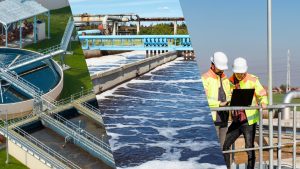
Australia has achieved a major milestone in sustainable water management with the launch of various groundbreaking initiatives. One of them is undoubtedly the widespread use of ‘Underground Water Maps’. These advanced, high-resolution maps provide detailed insights into the distribution, quality, and availability of groundwater across the country. This new technology promises to transform the Australian water industry by offering a crucial tool to tackle water scarcity issues.
This article will act as a guide to reveal the main applications of Underground Water Maps in water industry operations in Australia.
This article will act as a guide to reveal the main applications of Underground Water Maps in water industry operations in Australia.
We will discover
- What are Underground Water Maps?
- Top 4 Uses of Underground Water Maps for the Australian Water Industry
- Successfully Preparing for Droughts
- Water Infrastructure Development
- Aquifer Recharge Planning
- Well Placement and Drilling
3. Incorporating Underground Water Maps for Successful Water Distribution
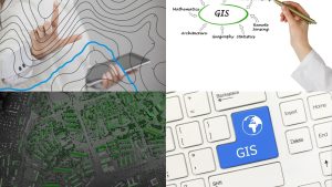
What are Underground Water Maps?

- Underground water maps, also known as groundwater maps, show the distribution and flow of water beneath the Earth’s surface. You already know what normal water maps do. They display surface water sources like rivers, lakes, and reservoirs. Going beyond these limitations, underground water maps focus on groundwater. That is the main difference.
- These maps provide some vital information about aquifers, which are natural underground storage areas for water. As you can see, the main difference between normal water maps and underground water maps lies in their focus. This means normal maps show visible bodies of water, while underground maps reveal hidden, subsurface water systems.
- The mechanism behind underground water maps wraps around several steps. It starts when scientists collect data from wells, boreholes, and other sources to understand the depth, extent, and movement of groundwater. They use this data to create detailed maps that illustrate different aquifers and their characteristics, such as water levels, flow directions, and quality. These maps normally use various colours and symbols to represent different types of groundwater, such as confined or unconfined aquifers, and to show areas where groundwater is more or less abundant.
- What is more, underground water maps help water industry professionals in many ways. They assist in managing water resources as they can identify where groundwater is available and ensure it is used sustainably. In the purest sense of the word, the underground water maps provide essential insights that support effective water management and ensure the sustainability of this vital resource.
Top 4 Uses of Underground Water Maps for the Australian Water Industry
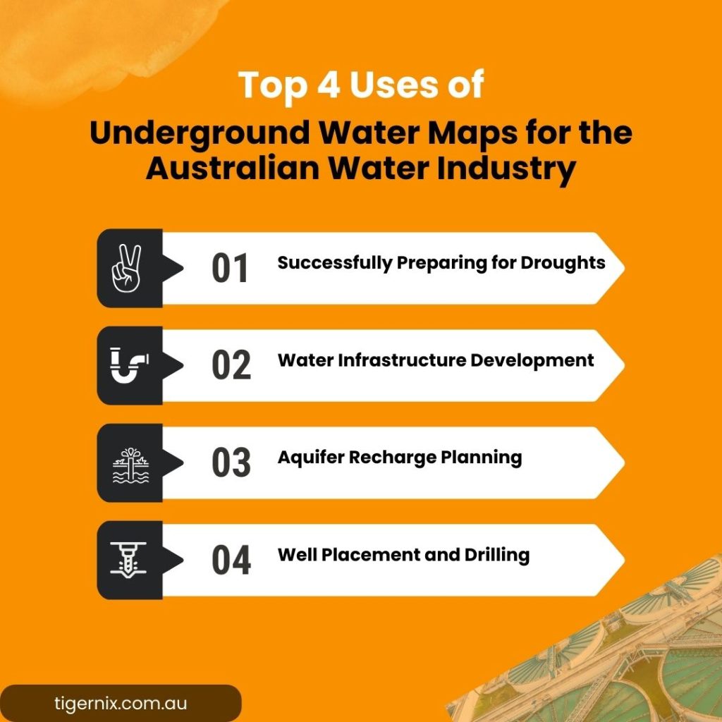
Successfully Preparing for Droughts
In a country like Australia, underground water maps receive limelight when preparing for and managing droughts. Let us elaborate on how this occurs.
You know that these maps offer vital information about the distribution and availability of groundwater resources. This information becomes especially important during periods of low rainfall. Australia’s diverse landscape is full of vast arid regions like the Outback, where surface water sources are scarce, and rainfall can be unpredictable.
During a drought, the surface water supplies, such as rivers and lakes, usually dry up. This makes groundwater a critical resource. If they incorporate underground water maps, they provide critical information for drought management by identifying alternative water sources during periods of low rainfall.
Plus, they show where groundwater is stored in aquifers beneath the surface, helping water managers find reliable sources of water even when surface water is not available. For example, underground water maps can highlight the locations of deep aquifers in areas like Western Australia, where rainfall is minimal and groundwater is essential for agriculture and urban use. If the water industry authorities can understand the location and capacity of these aquifers, they can plan for and manage water usage more effectively. This will ensure that essential services continue to operate during droughts.
Water Infrastructure Development
Australia: everybody knows this country as a terrain with diverse and often challenging landscapes. These maps provide detailed information about the location and quality of groundwater resources, which helps in planning and building infrastructure such as pipelines and treatment plants.
For instance, Australia’s vast and varied geography includes arid regions like the Outback and coastal areas with different groundwater characteristics. When using underground water maps, engineers and planners can determine the most suitable locations for new water infrastructure projects based on the availability of groundwater. They guide the construction of water infrastructure, such as pipelines and treatment plants, by indicating suitable locations based on groundwater availability.
They also assist in planning the route of pipelines to ensure they connect with groundwater sources effectively and efficiently. Also, when building treatment plants, these maps help locate facilities where groundwater quality is sufficient and where they can optimise treatment processes.
Aquifer Recharge Planning
These sorts of maps have the ability to offer detailed information about the locations and characteristics of underground water systems, obviously. Such ability helps water managers plan and execute aquifer recharge projects effectively as we stated before.
It works like this: Since they can identify recharge zones, underground water maps help in planning and managing artificial recharge projects to enhance groundwater levels. For example, in regions where agricultural activities heavily impact groundwater levels, these maps show areas where water can be introduced to replenish depleted aquifers. In areas with significant water scarcity, the maps identify zones where natural processes can be enhanced to increase groundwater storage.
These maps guide the selection of locations for recharge wells or basins, ensuring that water infiltrates into the aquifers where it is most needed. They also help in determining the volume and timing of recharge activities to match the needs of different regions. As they understand where groundwater naturally flows and accumulates, water managers can design recharge projects that maximise the efficiency of water use. This planning helps sustain groundwater supplies for agricultural, industrial, and urban needs, particularly during dry periods.
Well Placement and Drilling
Why are these things essential in the water industry in the first place?
Well placement and drilling are important for the water industry in Australia because they ensure access to groundwater resources, which are vital for drinking water, agriculture, and industry. If there is proper well placement, it will help to locate water sources efficiently, reducing the costs and time associated with drilling and increasing the chances of obtaining a good water yield.
This is where the underground water maps become essential tools. They easily provide detailed information about the location and characteristics of groundwater resources. These maps guide the optimal placement of wells by indicating areas with high groundwater potential, reducing drilling costs, and improving water yield.
Since they can use the information they receive via these maps, water managers can target their drilling efforts towards these high-potential areas rather than drilling blindly, which can be expensive and inefficient. In more populated areas, underground water maps help identify zones where groundwater levels are sufficient to support new wells without depleting existing resources.
In a way, this is a targeted approach, and it ensures that wells are placed in locations where they can provide a steady and reliable water supply. Not to forget that the maps help in planning the depth and construction of wells to optimise water extraction and minimise the impact on surrounding groundwater systems.
Incorporating Underground Water Maps for Successful Water Distribution

You may understand now that successful water distribution relies on accurate underground water mapping. If you collaborate with robust and innovative solutions, they provide seamless integration of underground maps with live data analysis. You can easily experience improved water resource allocation, operational efficiency and revolutionise your water management practices if you hold hands with the right supplier.