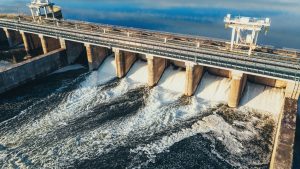
Did you know that floods cause an average of $1.2 billion in damages annually across the globe? As climate change continues to intensify, understanding and managing flood risks has become more challenging than the authorities ever imagined. That is where flood modelling technology comes in. It offers a powerful way to predict and assess flood risks with remarkable precision. Modern flood modelling is a fusion of advanced data, satellite imagery, and sophisticated software to simulate how rivers, streams, and even urban areas behave under flood conditions. This helps industries, urban planners, and environmental agencies design smarter, more resilient infrastructure.
In this article, we understand what flood modelling is and how it is used in industrial landscapes.
In this article, we understand what flood modelling is and how it is used in industrial landscapes.
What is Flood Modelling?

- Flood modelling is a way to simulate and understand how water behaves during flooding by using data, technology, and mathematical calculations. It predicts flood events, showing how water flows through rivers, urban areas, and natural landscapes during heavy rainfall or other triggers.
- When it comes to a flood model, it takes centre stage in planning projects that aim to reduce flood risk. It helps engineers, scientists, and urban planners understand how a river system reacts to different flood scenarios, such as rising water levels, overflow points, and potential areas of damage. This understanding allows people to make smarter decisions about where to build infrastructure, how to design flood barriers, and when to take protective actions.
- Now, let us get into its uniqueness. Flood models have the potential to analyse factors like rainfall patterns, soil saturation, river capacity, and terrain to create accurate predictions of flood behaviour. These models also help pinpoint vulnerable areas. The best part is they can offer insights into the best ways to protect lives, properties, and ecosystems.
- This is a technological miracle in the modern age as this process does not just manage risk. It actually turns detailed analysis into solutions that safeguard the environment and the people living in flood-prone regions.
This is How Flood Modelling is Used in Industrial Operations
Infrastructure Design and Resilience Planning
Designing and planning is the first step towards a booming infrastructure, and flood modelling can be used as the backbone of this process for industries worldwide.
Countries and the industrial world can use this technology to predict how water behaves during extreme weather events, ensuring their projects can withstand flood risks. Flood modelling helps industries analyse water flow patterns, identify areas prone to flooding, and plan where to build roads, bridges, and buildings.
Plus, engineers rely on this data to design drainage systems that handle heavy rainfall and prevent waterlogging. Companies involved in urban development also use flood modelling to ensure cities remain functional during storms. This technology helps industries simulate different scenarios, like intense rain or rising river levels, to prepare infrastructure that resists damage.
In another way, flood modelling supports resilience planning as it is capable of helping industries locate weak points in existing systems and prioritise upgrades. For example, factories can position machinery on higher ground, while power plants can protect critical components from water exposure. The insights from flood models guide decision-makers in choosing safer locations and materials for construction. When incorporating flood modelling into their strategies, industries not only protect investments but also minimise the risk of disruption.
As you can see, this technology simply bridges the gap between prediction and prevention, making infrastructure more assertive and adaptable to changing environments.
Site Selection and Risk Assessment
When selecting a new site for industrial operations, there are many boxes that need to be ticked.
This is where the flood modelling technology ensures no major risks are overlooked.
This advanced tool helps industries understand the flood risks of specific locations, allowing them to make smart choices about where to build factories, warehouses, or other facilities.
Flood modelling generates detailed simulations of water flow, rainfall impacts, and potential flood zones, helping industries predict how future floods might affect a site. Engineers and planners use this data to compare locations and identify the safest option for long-term operations. This technology does not just highlight flood-prone areas but also evaluates the severity and frequency of potential floods, giving industries a clear picture of risk levels.
So basically, flood modelling empowers industries to invest in locations that ensure safety, reduce financial losses, and maintain operational continuity during extreme weather. It transforms site selection into a science, blending technology and foresight to create a sustainable foundation for industrial success.
Wastewater and Effluent Management
Industries know wastewater and effluent management cannot be ignored, especially with the growing risk of floods and heavy rainfall.
Flood modelling technology has become a powerful tool to predict how flooding impacts wastewater systems, helping industries design efficient infrastructure and avoid environmental disasters. This technology simulates water flow patterns. It also shows areas where wastewater might overflow or where drainage systems could fail.
The industrial world can use these insights to build networks that handle sudden water surges, ensuring waste does not mix with clean water sources.
Flood modelling also helps industries plan the placement of treatment plants and pipelines in flood-prone areas. It identifies vulnerabilities so companies can upgrade old systems and prevent untreated wastewater from contaminating rivers and land. For industries dealing with hazardous materials, this technology guides the construction of secure containment zones, keeping harmful substances from spreading during floods.
This technology gives real-time data that helps industries respond to emergencies faster. It also ensures compliance with environmental regulations, reducing fines and ecosystem damage.
Urban and Regional Planning Collaboration
When planning new urban areas or upgrading existing ones, authorities cannot neglect the importance of understanding flood risks. Flood modelling helps planners predict how water will flow through cities during heavy rainfall or storms. These capabilities help them to design smarter infrastructure, such as roads, drainage systems, and flood barriers.
Urban and regional planners use these models to identify flood-prone zones and make decisions about where to place homes, businesses, and public services to avoid damage from future floods.
This technology also helps the zoning process, ensuring flood risks are factored into land-use decisions.
Planners can map flood zones and ensure that new developments are built in areas with low flood risk while also ensuring that existing infrastructure can handle increased water flow.
Energy Infrastructure Protection
This is one of the best technologies to protect energy infrastructure from flood damage.
Energy plants, power grids, and renewable energy sites like solar farms or wind turbines can be at risk during extreme weather events, especially floods. These models simulate how floodwaters will move and accumulate around energy infrastructure, allowing industries to assess their vulnerability to flood risks.
Energy companies can use flood modelling to plan where to build new facilities or how to upgrade existing ones to reduce the impact of flooding.
For example, if flood modelling indicates a high flood risk in a particular area, energy infrastructure might be placed on elevated ground or protected by barriers to keep water away.
Moreover, flood models help energy companies understand how floods can disrupt power generation or transmission lines.
In flood-prone areas, energy firms can use this data to create contingency plans, such as identifying backup power sources and ensuring that floodwater does not interfere with critical operations.
Scaling Up Risk Management with Modern Technology

Embracing modern risk management technology empowers industries to foresee potential hazards before they disrupt operations. If you opt for advanced modelling tools, you can predict risks precisely and implement effective solutions. Investing in these technologies is not a waste. But it is a boost for long-term operational resilience and safety. With the right tools from the right partner, the future is risk-managed!