Did you know that Australia is one of the top-ranking countries when it comes to mining industry operations and innovations? Due to its abundance of natural resources and crucial role in the production of most commodities, Australia continues to be one of the most significant nations for the mining sector. The country ranks well in the production of gold, zinc, nickel, cobalt, iron ore, and lithium. This is why the Australian government and the authorities pay much attention to the development of this particular industry. However, no industry in the world can stay away from specific risks and challenges when processing their operations. The mining industry in Australia is also the same in that case. This is why the Australian mining industry has started using robust technology like ‘Geographic Information System’ or GIS in their executions.
In this article, we will understand how GIS technology contributes to the mining industry in Australia in order to thoroughly clear away the risk factors.
We will know
- What is GIS Technology?
- What is the Mining Industry and What Sort of Risks Does It Face?
- Key GIS Technological Approaches to Reduce Mining Risks
- Spatial Analysis for Site Selection
- Predictive Modelling for Risk Assessment
- Real-time Monitoring of Operations
- Environmental Impact Assessment
4. Clearing Away Risk Factors Strategically via GIS Technology
What is GIS Technology?
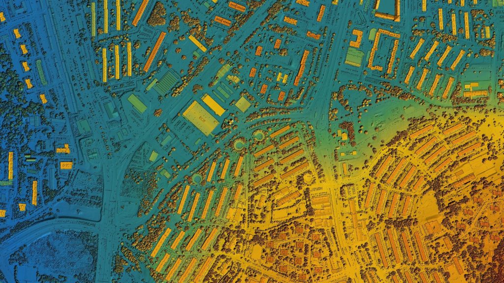
- This technology is a powerful tool that is usually used for capturing, storing, analysing, and visualising spatial data related to the Earth’s surface.
- If we look into the mechanism of this, it integrates various types of geographical information, such as maps, satellite imagery, and survey data, into a digital framework that allows users to understand patterns, relationships, and trends in the data. This is how GIS allows its users to create detailed maps, perform spatial analysis, and make informed decisions across a wide range of disciplines across Australia.
- Its application includes urban planning, environmental management, natural resource exploration, disaster response, etc. Since this has the power to overlay different layers of geographic information, GIS helps identify spatial patterns and relationships that may not be apparent in traditional data analysis methods.
- This thorough mechanism paves the way for better planning, management, and decision-making processes in both the public and private sectors in Australia when necessary.
What is the Mining Industry and What Sort of Risks Does It Face?
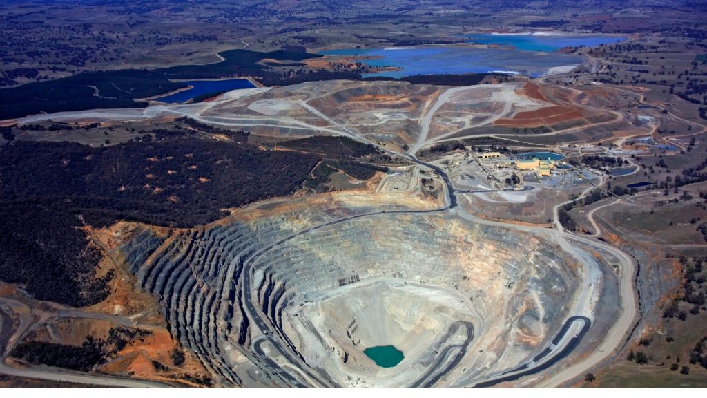
- This particular industry starts when the extraction of valuable minerals, ores, and other geological materials from the Earth’s crust happens. It basically involves activities such as exploration, extraction, processing, and transportation of these resources, which are essential for various industries, including manufacturing, construction, and energy production.
- However, the number of obstacles faced by the mining industry is also unlimited. For example, they encounter challenges when working with soil and earth surfaces, including soil erosion, land subsidence, and habitat destruction.
- On the other hand, soil contamination from mining activities can pose environmental risks. Plus, surface disturbances can impact ecosystems and water quality as the end result. Managing the usual operational floor and balancing such challenges can be successfully done if the authorities opt for effective mitigation measures and environmental monitoring to minimise negative impacts.
Key GIS Technological Approaches to Reduce Mining Risks

Spatial Analysis for Site Selection
When executing mining industry-specific operations, site selection receives top priority. GIS technology aids in risk prevention through its capability for spatial analysis for site selection in this scenario.
You know that GIS can analyse terrain, geology, hydrology, and proximity to sensitive environmental areas to pinpoint suitable mining locations. This process usually involves considering factors like environmental impact, geological stability, and accessibility.
However, the mining industry nowadays faces challenges in site selection due to increasing environmental regulations and community concerns. Not to mention that the depletion of easily accessible reserves has become problematic. GIS overcomes these hurdles easily by offering advanced spatial analysis tools that can handle large datasets. This incorporates complex environmental variables and visualises the results in interactive maps.
This is why mining companies tend to rely on this technology more often. They can identify optimal sites that balance resource richness with environmental sustainability, all while minimising mining risks.
It does not end there! GIS involves continuous monitoring and dynamic adjustment of site selection criteria based on evolving environmental conditions and regulatory requirements, on which Australia puts a lot of weight nowadays. The latter helps ensure mining operations remain compliant and environmentally responsible throughout their lifecycle.
Predictive Modelling for Risk Assessment
This model has gained immense popularity in the mining realm due to its foreseeing capabilities. Now let us inspect the mechanism. After combining historical data, geological surveys, and advanced predictive modelling techniques, GIS can easily assess and forecast various mining risks. This varies from slope instability and groundwater contamination to ore grade variability, etc.
This procedure identifies high-risk regions and possible threats by examining the geographical patterns and distributions of risk variables. Yet, since geological settings are dynamic and diverse and mining operations are inherently unpredictable, the mining sector confronts difficulties in assessing risk. This is where GIS becomes a vital tool.
GIS offers the best solution by providing powerful spatial analysis tools that can integrate diverse datasets, simulate multiple scenarios, and visualise predictive models in a geospatial context.
As you can see, mining companies can use GIS to proactively identify and prevent risks by implementing targeted measures such as reinforcement structures, groundwater management systems, ore blending strategies, etc.
It lays the path for a safer and more sustainable mining framework within Australia.
Real-time Monitoring of Operations
It is a common fact that the mining industry faces challenges due to the remote and often harsh environments in which mining operations take place. Plus, the complexity of integrating disparate data sources and monitoring systems can also be quite problematic.
However, there is no space for such obstacles when GIS is implemented as a strategy due to its capability for real-time monitoring of operations.
The procedure occurs like this. Through its ability to integrate with sensors and monitoring devices, GIS can provide real-time data on various aspects of mining operations, including equipment status, environmental conditions, and worker safety.
This helps in the timely identification of potential risks such as equipment failures, hazardous conditions, deviations from environmental regulations, etc. When the mining industry is concerned, prompt intervention means less of these risks.
Apart from that, GIS addresses the above-mentioned challenges by offering advanced spatial analysis features that can integrate and visualise real-time data streams from multiple sources, enabling mining companies to monitor operations comprehensively.
Environmental Impact Assessment
Mining is a major industry that is drastically associated with the environment. This is why mining authorities have to pay much attention to environmental impact in the first place.
GIS technology excels in risk prevention for the mining industry through its capability to conduct Environmental Impact Assessments, or EIAs, in short. If the authorities are able to overlay mining plans with environmental data layers such as habitat maps, water resources, and air quality, the risks can be identified immediately, and that is exactly what GIS facilitates.
This spatial analysis permits mining companies in Australia to identify potential impacts on ecosystems and surrounding environments as an advanced step. The latter allows for proactive measures to minimise or stay away from environmental risks that are associated with heavy mining activities.
In another way, GIS addresses these challenges by providing powerful spatial analysis tools that can integrate diverse environmental datasets. This is possible via the visualisation of spatial relationships and simulation of the potential impacts of mining activities on ecosystems and landscapes.
Clearing Away Risk Factors Strategically via GIS Technology

Australia has come a long way when it comes to the mining industry. Still, there is a long path to go on, and staying away from negative environmental impacts is the number one priority in that case. Collaborating with the right technologies, like GIS, from a reputed software partner will keep most of the obstacles out of your path, for sure.