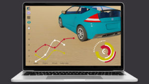
A sustainable future for road vehicles will be largely shaped by satellite data and communications. For urban planners, this technology is a need since it helps them find the quickest ways to build roadways and identify subpar ones. With the help of this technology, road management operations, including planning, engineering, building, maintaining, and reconstructing roads, can be optimised by identifying disaster factors, expensive mistakes, and other geological informational additions. A real advance in pavement management is satellite technology (InSAR, SAR, PSInSAR, SqueeSAR, and others), which can provide millimetre-accurate information on deformations and risks of road infrastructure. This opens up priceless opportunities for road asset managers to consistently make wise maintenance decisions. Read on to discover how satellite technology can assist road asset managers in shaping a more efficient roading industry.
Reforming The Roading Industry With Satellite Technology
Utilising a range of satellite technologies, including navigation, Earth Observation (EO) imagery and communications, road asset managers realise the potential of satellite technology in the roading industry. Here are 4 ways in which satellite technology can optimise this sector:
Predictive and Prescriptive Maintenance
InSAR is a form of satellite-based technology that can detect the deterioration of transportation infrastructure in vast areas reaching as far as 120,000 KM and detect long-term criticality. Utilising cutting-edge remote signalling, it keeps track of the state of the nation’s roads while taking into account factors like demographic information, road usage, and neighbourhood effects. It can use weather patterns to forecast natural disasters and alert management of slope instability. Therefore, management can take precautions to safeguard or reinforce road infrastructure in landslide-prone areas to ensure minimal damage. Using satellite technologies, destructive risks such as floods and sinkholes can also be monitored. It would make transportation fail-safe; even if some data networks break down, satellites can collect and receive data.
Real-time Feedback At Your Fingertips
Road management can receive precise and up-to-the-minute geographic references from satellite technology by combining GIS data and satellite photos with remote sensing technologies. The utilisation of satellite data can help reduce some congestion on our highways. Earth-orbiting satellites will be able to detect traffic jams and accidents and alert transportation hubs when they do. These transportation hubs will be able to alert nearby vehicles and reroute them to a shorter or more effective route. The vehicles engaged in an accident may automatically alert the nearby transportation hub when one occurs. A quick assessment of the accident’s severity will enable the dispatch of emergency services, if necessary. GNSS technology will ensure the incident’s location is immediately known to the emergency services.
Safer Now Than Ever
You can keep an eye on the fleet wherever it is, thanks to the monitoring features of satellite tracking. You may connect with your team and take appropriate action if necessary by using automated alerts to spot any unusual movement. The drivers benefit from this efficiency, and satellite tracking actually increases team production. Fleet utilisation rises with real-time visibility into the hours and availability of drivers, which also ensures operator compliance. The monitoring of driving behaviour also motivates drivers to take safety precautions when operating a vehicle. Satellites will also be able to detect extreme weather, such as snowstorms. The nearby transfer hub will be notified of this information. This will, in turn, send a notification to every vehicle in the affected area. By providing timely location-related information like traffic delays, route modifications, and predicted arrival times, satellites enhance the driving experience. Access to this information ensures drivers and other road users get from Point A to Point B safely and removes distractions.
Bid Farewell To Pollution, And Welcome The New Green
Innovative, cutting-edge satellite-enabled technology will improve safety in transportation systems and boost the effectiveness of current transportation infrastructure by reducing congestion. This could thus have favourable effects on the environment, resulting in a decrease in air and noise pollution, a crucial component of innovation in the transportation industry. The concept of “smart transportation” centres on reducing negative environmental effects, specifically via reducing energy use and air pollution. The market already has a number of smart transportation-related products. The ability of smart transportation to react to changing situations, such as traffic monitoring, vehicle location, and weather conditions, depends on satellite data. Operators of vehicle fleets can improve their operations’ efficiency and put an end to costly, resource-wasting, and potentially environmentally hazardous present practices by evaluating and exploiting data obtained from Global Positioning Satellite (GPS) systems.
The Roading Industry's 4.0 Future: Are You Prepared To Embrace It?
The ongoing advancement of satellite technology will increase traffic safety and facilitate travel. If their capacities are used, it offers a priceless opportunity for the transportation sector. Innovating to secure a more effective, more mobile, and more connected future, satellite technology can show a variety of communication, navigation, and observation options and help public authorities future-proof crucial transportation networks. Furthermore, utilising satellite technology to assist the most vulnerable is part of intelligent mobility. Are you ready to step into the new age of technology and develop the roading industry of the future?