Australia’s vast geography demands a highly structured approach to road planning, classification, and maintenance. With over 877,000 km of roads spanning diverse terrains, from dense urban centres to remote outback highways, the need for clear classification systems becomes essential.
This article explains how Australia road classifications work, how they are managed, and how modern technologies are transforming road asset strategies.
We will discover
- Why Does Australia Need Multiple Road Classification Systems?
- What Are the Three Fundamental Classification Approaches?
- How Does Australia’s Administrative Road Hierarchy Work?
- How Do Alphanumeric Road Numbering Systems Identify Routes?
- What Is AusRAP and How Does It Rate Road Safety?
- How Do Freeways and Motorways Differ from Other Road Classes?
- What Defines State Highways and How Are They Managed?
- What Is the Movement and Place Framework Replacing SmartRoads?
- How Do Smart Technologies Transform Road Classification Management?
- What Asset Management Challenges Arise From Classification Complexity?
- How Can Road Authorities Optimise Classification-Based Asset Strategies?
- FAQs About Australia Road Classifications
Why Does Australia Need Multiple Road Classification Systems?
Australia uses multiple road classification systems to efficiently manage its extensive and diverse road network. These systems help allocate funding, define responsibilities, and ensure consistent design and maintenance standards across federal, state, and local levels.
Key Takeaways
- Australia road classifications use multiple systems, such as functional, administrative, and structural, to efficiently manage one of the world’s largest and most complex road networks.
- The lack of a unified national standard creates challenges in funding, maintenance consistency, and interstate coordination across different government levels.
- Modern frameworks like the Movement and Place Framework, along with tools and safety ratings, are improving planning, safety, and decision-making.
- Smart technologies like AI, GIS, and digital twins are transforming road asset management systems, enabling predictive maintenance and long-term infrastructure optimisation.
Managing 873,573 km of Roads Across Six States and Two Territories
Australia maintains approximately 873,573 km of road network, one of the largest globally relative to population size.
This network spans urban cities, coastal regions, and remote inland areas. Because of this scale, a single classification system cannot effectively address all operational needs.
Different regions face unique challenges, such as urban congestion in Sydney versus remote accessibility in the Northern Territory. This is when classification helps segment responsibilities and tailor maintenance approaches.
Without structured systems, coordinating infrastructure planning across such a vast geography would be inefficient and costly.
The Challenge: No Unified National Classification Standard Since the ICSM 2006 Report
Australia does not have a fully unified national classification framework since the ICSM standards report in 2006. While guidelines exist, states have developed their own systems over time.
This lack of uniformity creates inconsistencies in planning, road safety, and maintenance standards. For example, a road classified as ‘arterial’ in one state may differ in design or priority in another.
This fragmentation continues to challenge nationwide infrastructure coordination.
What Are the Three Fundamental Classification Approaches?
Australia classifies roads using three main approaches: functional classification, administrative classification, and structural/design classification. Each serves a unique purpose in planning, funding, and infrastructure design.
Functional Classification: Mobility Versus Property Access Balance
Functional classification focuses on how roads are used. It balances traffic mobility (moving vehicles efficiently) with land access (connecting properties and local destinations).
High-mobility roads prioritise speed and long-distance travel, while access-focused roads serve local communities. This approach helps planners decide road capacity, speed limits, and connectivity.
Understanding this balance is important when analysing functional vs administrative classification differences.
Administrative Classification: Federal, State, and Local Government Tiers
Administrative classification defines who owns and maintains the road. This includes federal highways, state-managed routes, and council roads.
Further, this system determines funding allocation, maintenance standards, and operational responsibility. It ensures that each level of government can manage infrastructure effectively while maintaining national connectivity. It also supports accountability across jurisdictions.
Structural/Design Classification: Geometric and Operational Characteristics
Structural classification focuses on engineering design. It considers lane width, pavement type, traffic capacity, and safety features.
For example, highways require wider lanes, stronger pavement, and better access control compared to suburban streets. This classification ensures that roads are built to handle expected traffic loads and environmental conditions.
Why These Systems Overlap Yet Serve Different Purposes
Although these classifications overlap, each serves a distinct purpose.
Functional classification guides usage, administrative classification assigns responsibility, and structural classification defines design.
Together, they form a comprehensive framework that supports planning, funding, and maintenance. This layered approach allows Australia to manage a complex and diverse road network effectively.
How Does Australia's Administrative Road Hierarchy Work?

Australia’s administrative road hierarchy divides roads into national highways, state roads, and local roads based on ownership and responsibility. This system ensures efficient funding allocation and maintenance management.
National Highways: Federally-Funded Strategic Interstate Routes
It is evident that national highways are critical routes connecting major cities and supporting economic activity. Under the National Highway Classification, these roads receive federal funding but are often managed by state agencies.
They carry a significant portion of freight and long-distance travel. Maintaining these roads is crucial for economic productivity. For instance, freight transport contributes over $66 billion annually to Australia’s GDP, heavily relying on national highways.
State Highways and State Roads: State Government-Controlled Networks
State governments manage major regional roads that connect towns, cities, and economic hubs. These include state highways, which support both passenger and freight movement.
These roads often experience mixed traffic conditions, requiring careful design and maintenance. States allocate budgets based on traffic volume, economic importance, and infrastructure condition, ensuring consistent service levels.
Main Roads: Regionally Significant Routes Managed by States
Main roads serve as key connectors between local and major transport routes. They are vital for regional development and accessibility.
Although not as critical as highways, they support local economies by connecting agricultural areas, industrial zones, and smaller communities.
Their maintenance often reflects regional priorities and available funding.
Local Roads: Council-Maintained Urban Streets and Rural Routes
Local councils manage approximately 75% of Australia’s road network, primarily consisting of local roads. These roads provide direct access to homes, schools, and businesses.
Despite their importance, local councils often face funding challenges. Limited budgets can lead to deferred maintenance, impacting road quality and safety over time.
The Funding and Responsibility Allocation Challenges
Funding disparities between federal, state, and local levels create ongoing challenges. While national highways receive significant investment, local roads often struggle with maintenance backlogs.
This imbalance highlights the importance of effective classification systems. By clearly defining responsibilities, governments can better allocate resources and prioritise infrastructure investments.
How Do Alphanumeric Road Numbering Systems Identify Routes?
Australia uses an alphanumeric road numbering system with prefixes like M, A, B, and C to identify road types and importance. This system helps drivers navigate efficiently and understand route significance.
‘M’ Prefix: Motorways and Freeways (Gold-on-Green/Blue Signs)
The ‘M’ prefix represents high-capacity roads, including freeways and motorways designed for fast and uninterrupted travel.
These roads feature multiple lanes and limited entry points.
They are marked with distinct signage for easy recognition. These routes carry heavy traffic volumes and are essential for urban and intercity travel.
‘A’ Prefix: National Highway Routes Connecting Capital Cities
‘A’ routes are major roads connecting capital cities and regional centres.
They are slightly lower in capacity than M roads, but still play a crucial role in national connectivity.
These routes often overlap with highway designation systems and are critical for long-distance travel and freight movement.
‘B’ and ‘C’ Prefixes: State Highways and Main Roads (Bullet Signs)
‘B’ and ‘C’ routes represent secondary roads. They connect smaller towns and regional areas.
While these roads may not have high traffic volumes, they are essential for local connectivity. They also support tourism and regional economies.
‘MR’ Designations: Main Road Administrative Classifications
‘MR’ stands for Main Roads and is used for administrative purposes. These designations help governments track and manage road assets more effectively.
They are not always visible to the public, but they play a key role in planning and maintenance.
State Variations: NSW, VIC, QLD, WA, SA, TAS, NT, Different Systems
Each state has slight variations in numbering and classification.
While the core system is similar, implementation differs based on regional needs.
This variation adds complexity but allows flexibility in managing diverse road networks across Australia.
What Is AusRAP and How Does It Rate Road Safety?
AusRAP star safety ratings measure road safety performance by scoring roads from 1-star (least safe) to 5-star (safest). These ratings are based on road design, traffic conditions, and crash risk factors to guide investment and upgrades.
Australian Road Assessment Programme Evaluating 21,921 km of National Highways
The Australian Road Assessment Programme (AusRAP) evaluates over 21,921 km of national highways, focusing on high-risk corridors. It provides data-driven insights into road conditions and crash risks.
This programme is crucial because road crashes cost Australia over $30 billion annually in economic and social impacts. By identifying dangerous sections, AusRAP helps authorities prioritise safety upgrades and allocate funding more effectively.
1-Star (Least Safe) to 5-Star (Most Safe) Ratings Methodology
AusRAP uses a star rating system from 1 to 5.
A 1-star road has a high crash risk, while a 5-star road offers the highest level of protection.
The methodology considers factors such as lane width, roadside hazards, and intersection design. These ratings provide a simple yet powerful way for policymakers to understand road safety performance and make informed decisions.
Assessment Factors: Divided Carriageways, Barriers, Line Marking, Roadside Hazards
AusRAP evaluates multiple design elements, including divided carriageways, safety barriers, line markings, and roadside obstacles.
For example, roads with median barriers significantly reduce head-on collisions. Clear markings and proper signage improve visibility and driver behaviour.
These elements collectively influence safety outcomes and overall risk levels.
2025 AusRAP Report Findings and Safer Roads Investment Plans (SRIPs)
Recent AusRAP findings highlight that a significant portion of highways still fall below 3-star safety standards.
The 2025 reports emphasise targeted investment through Safer Roads Investment Plans (SRIPs).
These plans outline priority upgrades, including barrier installations and shoulder widening. Strategic investments can deliver up to 4:1 economic returns, making safety improvements both life-saving and cost-effective.
Why 1-Star and 2-Star Roads Require Urgent Safety Upgrades
1-star and 2-star roads pose the highest risk of serious accidents. These roads often lack basic safety features such as barriers or adequate shoulders.
Upgrading these roads can dramatically reduce fatalities.
Studies show that improving a road from 2-star to 3-star can reduce fatal crashes by up to 50%, highlighting the urgency of targeted interventions.
How Do Freeways and Motorways Differ from Other Road Classes?
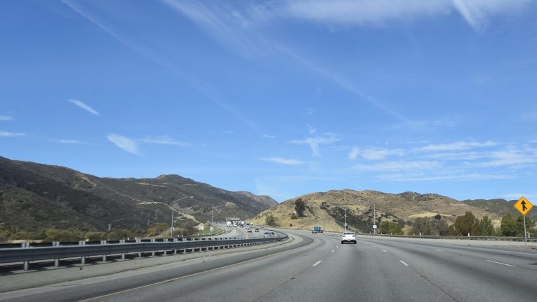
- Controlled-Access Highways: No At-Grade Intersections or Property Access
- Grade-Separated Interchanges and Dedicated Ramps/Slip Roads
- Divided Carriageways with Central Median Barriers
- Multi-Lane Configuration Enabling High-Speed Traffic Flow (100–110 km/h)
- Examples: M1 Pacific Motorway, M2 Hills Motorway, M80 Ring Road
What Defines State Highways and How Are They Managed?
State highways are major regional roads managed by state governments. They connect cities, towns, and economic zones while supporting both freight and passenger transport.
Strategic Inter-Regional Routes Connecting Major Centres
State highways form the backbone of regional connectivity. They link major cities with smaller towns and industrial areas.
These roads support agriculture, tourism, and trade. For example, regional freight routes carry a significant share of Australia’s exports, particularly in the mining and agriculture sectors.
State Government Funding and Maintenance Responsibilities
State authorities are responsible for funding, maintaining, and upgrading these roads. This includes resurfacing, signage, and safety improvements.
Budgets are allocated based on traffic demand and economic importance.
States collectively spend billions annually on road infrastructure to maintain service levels.
Mixed-Use Corridors Balancing Freight, Commuters, and Local Traffic
Unlike motorways, state highways handle mixed traffic. This includes heavy trucks, commuters, and local vehicles.
Balancing these demands requires careful planning. Authorities must ensure efficiency while maintaining safety for all users, making management more complex.
Typical Design Standards: Lane Widths, Shoulder Requirements, Signage
State highways follow strict design standards, including lane widths, shoulder space, and road signage requirements.
These standards ensure consistency and safety across regions. Proper design also supports long-term durability and reduces maintenance costs.
Examples: Pacific Highway (NSW), Great Ocean Road (VIC)
Examples include the Pacific Highway in New South Wales and the Great Ocean Road in Victoria.
These routes are not only transport corridors but also important tourism assets, attracting millions of visitors each year.
What Is the Movement and Place Framework Replacing SmartRoads?
The Movement and Place Framework is a modern planning approach that balances traffic movement with community needs. It replaces older systems by integrating transport efficiency with urban design.
Austroads' Modern Approach to Network Planning and Operation
Developed under Austroads guidelines, this framework reflects a shift toward people-focused transport planning.
It considers not just vehicles but also pedestrians, cyclists, and public transport. This holistic approach improves urban livability while maintaining network efficiency.
Balancing Movement (Traffic Flow) with Place (Urban Amenity)
The framework introduces a dual concept: movement and place. Movement focuses on transport efficiency, while place considers social and environmental value.
Balancing these factors ensures roads serve both mobility and community needs, particularly in urban areas.
Road Use Hierarchy (RUH) Defining Modal Priorities by Time of Day
The Road Use Hierarchy (RUH) assigns priority to different transport modes depending on time and location.
For example, a road may prioritise vehicles during peak hours and pedestrians during off-peak times. This flexibility improves overall network performance.
Integration with Urban Design and Town Planning Objectives
The framework integrates transport planning with broader urban development goals.
It supports sustainable growth by aligning infrastructure with land use, reducing congestion, and improving the quality of life.
How Do Smart Technologies Transform Road Classification Management?

Smart technologies transform road classification management by using data-driven tools like GIS, digital twins, and AI to monitor infrastructure, predict maintenance needs, and optimise investment decisions across road networks.
GIS Mapping: Visualising Entire State/Territory Road Networks
As you can see, modern GIS mapping systems allow authorities to visualise entire road networks in real time.
These platforms integrate spatial data with infrastructure attributes, helping planners understand road distribution, usage, and condition.
By mapping every segment, agencies can identify congestion points, maintenance needs, and high-risk zones. Australia invests heavily in geospatial infrastructure, with over 80% of transport agencies now relying on GIS-based platforms for planning and decision-making.
Digital Twin Creating Virtual 4D Models of Road Infrastructure
A digital twin creates a virtual replica of physical road assets, including time-based (4D) changes. This allows engineers to simulate traffic patterns, weather impacts, and infrastructure wear.
These models enable proactive planning and reduce unexpected failures. Governments using digital twins have reported up to 30% reduction in maintenance costs, as predictive insights replace reactive repairs.
AI and IoT Sensors Assessing Pavement Condition and Criticality
Advanced systems use sensors and AI analytics to monitor pavement conditions continuously. IoT devices collect data on traffic loads, temperature, and surface wear.
This data feeds into intelligent models that assess road condition assessment metrics and predict future deterioration. These insights allow authorities to act before roads reach critical failure points.
Criticality Tagging: ‘Very Poor’ to ‘Very Good’ for Maintenance Prioritisation
Road segments are now assigned asset criticality ratings such as ‘Very Poor’ to ‘Very Good.’ This classification helps prioritise maintenance activities.
High-criticality roads, such as major highways, receive immediate attention, while lower-priority roads are scheduled accordingly.
This approach improves efficiency and ensures optimal use of limited resources.
Automated CCTV Inspection Robots Scanning Surfaces in Hours vs Months
Automated inspection tools, including CCTV-enabled robots, can scan road surfaces quickly and accurately.
What once took months of manual inspection can now be completed in hours. This improves data accuracy and reduces operational costs, allowing faster response to infrastructure issues.
What Asset Management Challenges Arise from Classification Complexity?
Road classification complexity creates challenges in funding allocation, maintenance consistency, and data integration across federal, state, and local systems, making coordinated infrastructure management more difficult.
Different State Systems Complicating Interstate Route Management
Each state in Australia uses slightly different classification systems, creating inconsistencies in managing interstate routes.
This fragmentation complicates planning and coordination, especially for long-distance corridors.
It also affects route numbering consistency, making navigation and infrastructure management more complex.
Budget Allocation Disparities Between Road Classes
Funding is often unevenly distributed across road classes. High-priority roads receive more investment, while lower-tier roads face funding gaps.
This imbalance affects infrastructure investment efficiency and long-term sustainability. It also increases the risk of deterioration in less-funded networks.
Maintenance Standards Varying by Administrative Responsibility
Maintenance quality can vary depending on whether a road is managed by federal, state, or local authorities.
This variation leads to inconsistencies in infrastructure maintenance practices. For example, a highway may be well-maintained, while adjacent local roads may show signs of neglect.
Data Integration Challenges Across Federal, State, and Local Systems
Integrating data across multiple jurisdictions remains a major challenge. Different systems, formats, and standards hinder seamless information sharing.
Without unified platforms, decision-making becomes slower and less effective. This highlights the need for integrated road asset management systems to improve coordination.
How Can Road Authorities Optimise Classification-Based Asset Strategies?

Road authorities can optimise asset strategies by linking road classifications to maintenance schedules, using predictive analytics, and aligning long-term investment plans with infrastructure priorities.
Linking Classification Tiers to Maintenance Frequency and Budgets
Different road classes require different maintenance schedules.
High-priority roads need frequent inspections, while lower-tier roads can follow longer cycles.
By aligning budgets with classification tiers, authorities can allocate resources more effectively. This ensures critical roads remain operational while optimising overall spending.
Predictive Analytics Forecasting Degradation by Road Type
Using predictive models, authorities can forecast how different road types will degrade over time.
These insights help plan maintenance before failures occur. Predictive systems can reduce lifecycle costs by up to 25%, making them a valuable tool in modern infrastructure management.
10-Year Investment Profiles Aligning Funding with Strategic Priorities
Long-term planning is essential for sustainable infrastructure. Authorities develop 10-year investment strategies to align funding with national and regional priorities.
These profiles consider traffic demand, economic impact, and road condition. This approach ensures consistent funding and reduces reactive spending.
Risk-Based Approaches Protecting Critical National Highway Corridors
Risk-based strategies focus on protecting high-value assets, such as national highways.
By identifying vulnerabilities and prioritising critical routes, authorities can minimise disruptions and ensure network resilience. This is particularly important for freight corridors that support economic activity.
Why Choose Tigernix for Highway and Road Asset Management?
Tigernix Highway Asset Management and Visualisation software solution provides advanced digital solutions for managing road infrastructure using AI, GIS, and predictive analytics. It enables authorities to monitor assets, optimise maintenance, and improve long-term infrastructure performance.
Complete Transportation Asset Suite: Managing Highways, Bridges, Freeways, Footpaths
Tigernix software suite offers a comprehensive platform designed to manage all transport assets, including highways, bridges, urban streets, and pedestrian pathways.
This unified system eliminates data silos and provides a single source of truth. With increasing infrastructure demands, Australia invests over $120 billion annually in transport infrastructure; integrated solutions are essential for efficient asset management.
Digital Twin, GIS, AI/ML, and Predictive Analytics Integration
Our robust platform integrates advanced technologies such as GIS mapping, digital twin, and AI-driven analytics.
These tools provide real-time insights into asset performance and future risks. By combining multiple technologies, the Tigernix suite enables smarter decision-making and improves operational efficiency across road networks.
Criticality-Based Tagging From ‘Very Poor’ to ‘Very Good’
Tigernix uses intelligent classification models to tag assets based on condition and importance.
This system supports pavement management by prioritising maintenance activities. Authorities can quickly identify high-risk areas and allocate resources accordingly, improving safety and performance.
10-Year Budget Scenario Simulation and Risk Forecasting
The platform supports long-term planning through scenario modelling and forecasting.
Authorities can simulate different budget allocations and assess their impact on infrastructure performance. This ensures sustainable investment strategies and reduces unexpected costs over time.
Tigernix-Where Every Road Is Digitalised
Ready to Modernise Your Road Asset Management System?
Modernising road asset management systems with smart technologies improves efficiency, reduces costs, and enhances road safety. Digital solutions enable real-time monitoring and long-term planning.
Schedule Consultation With Tigernix Transportation Specialists
Organisations can begin their transformation by consulting with Tigernix experts.
Our specialists assess current systems and recommend tailored solutions. This ensures a smooth transition to modern infrastructure management practices.
Call for a free demo now.
Discover How Smart Technology Optimises Maintenance Across All Road Classes
Smart platforms provide real-time insights into infrastructure performance. This allows authorities to optimise maintenance schedules across all road categories.
By leveraging technology, organisations can reduce costs, improve service quality, and extend asset lifespan.
Implement Industry 4.0 Solutions for Sustainable Road Network Management
Industry 4.0 technologies, including AI and IoT, are reshaping infrastructure management.
These solutions support sustainability by reducing waste, improving efficiency, and enabling data-driven decisions. As infrastructure demands grow, adopting smart systems becomes essential for long-term success.
FAQs About Australia Road Classifications
Australia road classifications are systems used to categorise roads based on function, administration, and design. They help governments manage infrastructure, allocate funding, and maintain standards across national, state, and local road networks. These classifications ensure efficient transport planning and consistent road performance.
Australia uses multiple classification systems to handle its vast and diverse road network effectively. Each system serves a different purpose, such as functional, administrative, or structural, allowing better planning, funding allocation, and maintenance. This layered approach ensures roads meet both mobility and local access needs.
The alphanumeric road numbering system uses prefixes like M, A, B, and C to identify road importance and type. ‘M’ roads are motorways, ‘A’ roads are major highways, and ‘B’ and ‘C’ roads serve regional and local routes. This system improves navigation and route identification for drivers.
AusRAP star safety ratings evaluate roads from 1-star (least safe) to 5-star (safest) based on design and risk factors. These ratings help governments prioritise safety upgrades and reduce crash risks. Improving low-rated roads can significantly decrease fatalities and serious injuries.
Smart technologies like AI, GIS, and digital twins enhance road asset management systems by enabling real-time monitoring and predictive maintenance. These tools help authorities assess road conditions, prioritise repairs, and optimise long-term investments, improving efficiency and infrastructure performance.