According to reports, 2025 is known as the cosliest year ever when it comes to global climate disasters. The global economy lost $ 55 billion solely due to them. Extreme weather is no longer a seasonal inconvenience. For water utilities, wastewater treatment plants, and transportation operators, storms directly impact compliance, safety, budgets, and public trust. As we can see, a sudden downpour can overwhelm sewer networks. Also, a cyclone can shut down transport corridors. A fast-moving storm can flood pump stations before crews even mobilise.
In this climate-driven reality, a live satellite map is no longer just a weather visualisation tool. It is a strategic operational asset.
With real-time weather tracking, infrastructure managers can monitor storm formation, analyse wind speed and pressure overlays, activate severe weather alerts, and protect assets before impact occurs. Instead of reacting to damage, organisations can anticipate risk using live satellite imagery, precipitation maps, and evolving storm paths.
This article explains how to use a live satellite map effectively in the water, wastewater, and transportation industries, and how modern storm-tracking technology strengthens infrastructure resilience.
We will discover
- Why Real-Time Weather Visibility Matters for Critical Infrastructure
- What Is a Live Satellite Map and How Does It Work?
- How to Use a Live Satellite Map for Storm Tracking and Infrastructure Protection
- Key Features to Look for in an Interactive Satellite Weather Map
- Best Practices for Implementing Real-Time Storm Tracking for Utilities
- The Role of Live Satellite Maps in Climate Risk Management and Regulatory Compliance
- How Artificial Intelligence Enhances Live Satellite Weather Monitoring
- FAQs About Live Satellite Map
Why Real-Time Weather Visibility Matters for Critical Infrastructure
Traditional forecasts provide summaries. However, infrastructure operators need continuous real-time weather data, severe weather alerts, and actionable visibility
A live weather map for operational decision-making allows teams to anticipate developing threats rather than respond to crisis alerts. With the right interactive weather maps, operators can:
- Monitor developing storm systems before rainfall begins
- Trigger automated severe weather alerts once defined thresholds are exceeded
Key Takeaways
- A live satellite map enables real-time storm tracking and infrastructure protection.
- Real-time weather tracking helps water, wastewater, and transportation sectors prevent costly disruptions.
- Severe weather alerts and predictive analytics transform reactive response into strategic resilience.
- Integrating satellite data with AI, IoT, and digital twins strengthens long-term climate risk management.
What Is a Live Satellite Map and How Does It Work?
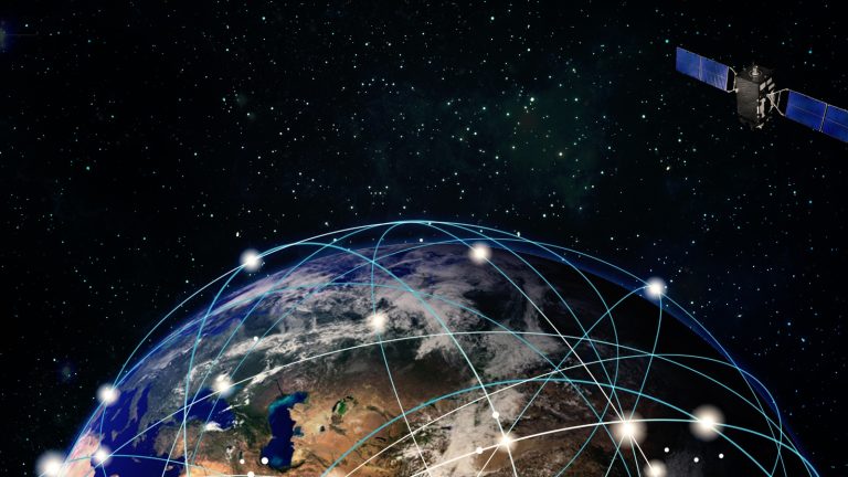
A live satellite map is a continuously updated visualisation generated from orbiting satellites that monitor atmospheric conditions worldwide. Unlike local radar systems, weather satellite imagery captures large-scale cloud systems, oceanic disturbances, and continental storm movement.
Live Satellite Imagery and Atmospheric Data
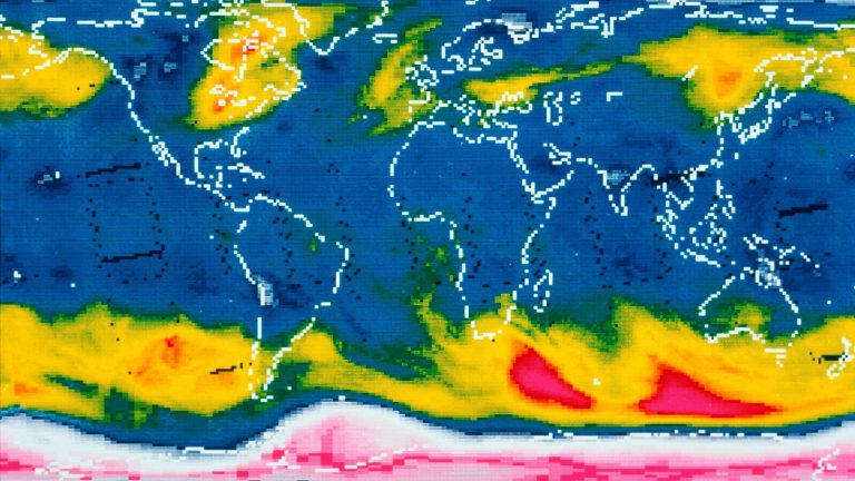
Modern satellites collect multiple data layers displayed on interactive satellite weather maps, including visible imagery, infrared cloud-top temperature readings, and water vapour patterns. These layers help operators understand storm structure, moisture buildup, and intensification patterns.
The Difference Between Radar and Satellite Weather Maps
Understanding the difference between radar and satellite weather maps improves operational accuracy.
Radar systems generate precipitation radar maps that measure rainfall intensity within a localised range. Satellite systems track broader atmospheric movement, supporting hurricane and cyclone tracking long before rainfall begins.
For infrastructure protection, both tools are valuable. Radar confirms local precipitation levels. Satellite monitoring for infrastructure predicts incoming systems before impact.
How to Use a Live Satellite Map for Storm Tracking and Infrastructure Protection
A storm tracker online platform provides access to live weather maps. But strategic use is what delivers resilience.
Monitoring Storm Formation and Movement in Real Time
Effective real-time storm tracker use begins with observing cloud clusters and pressure systems before landfall. Wind speed and pressure overlays help detect intensification zones.
For wastewater facilities, early identification of heavy rainfall systems allows operators to lower storage basins and activate contingency pumps. For transportation managers, monitoring storm direction enables route planning adjustments before closures occur.
Modern storm tracking technology also supports hurricane and cyclone tracking across oceans, providing extended preparation time for coastal infrastructure using severe weather alerts.
Assessing Flood Risk With Satellite Monitoring for Infrastructure
It is common knowledge that flooding often originates upstream. A flood monitoring weather map integrated with watershed data helps utilities anticipate how satellites help predict flooding events before river levels rise.
By analysing precipitation maps and soil saturation indicators, operators can anticipate inflow surges and prevent combined sewer overflows.
Weather data integration with infrastructure systems transforms satellite imagery into predictive alerts. Instead of waiting for floodwaters to reach critical levels, facilities respond in advance.
Supporting Transportation Weather Monitoring
Nowadays, we can see that transportation networks depend heavily on real-time weather tracking. Severe weather can disrupt ports, highways, and rail systems rapidly.
Using interactive weather maps, fleet managers can analyse wind speed overlays and precipitation radar maps to determine safe travel windows. This improves driver safety, reduces fuel waste, and minimises cargo delays.
Not to mention that an advanced interactive satellite weather map becomes the central dashboard for logistics coordination during severe weather events.
Activating Severe Weather Alerts Before Impact
A key benefit of a professional weather tracker is automated alerting. This is where Customisable layers for weather monitoring allow organisations to define rainfall or wind thresholds that trigger action.
Once activated, severe weather alerts can prompt crew deployment, infrastructure protection protocols, or operational slowdowns. This structured response reduces panic-driven decisions and enhances coordination.
For utilities adopting real-time storm tracking for utilities, automation improves both safety and regulatory compliance.
Key Features to Look for in an Interactive Satellite Weather Map
- High-Resolution Live Satellite Imagery With Frequent Refresh Rates
- Radar + Satellite Layers in a Unified Interface
- Wind Speed and Pressure Overlays for Storm Intensity Monitoring
- Precipitation Maps and Precipitation Radar Map Integration
- Historical Playback for Storm Pattern Analysis
- Customisable Layers for Weather Monitoring
- Mobile Accessibility for Field Operators
- API Support for Weather Data Integration With Infrastructure Systems
When selecting weather monitoring tools used by professionals, integration capability is critical. A fully connected interactive satellite weather map transforms raw weather data into operational intelligence.
Best Practices for Implementing Real-Time Storm Tracking for Utilities
Technology alone does not create resilience. Process alignment and disciplined execution determine success.
Establish Clear Operational Weather Thresholds
Define rainfall intensity, wind speeds, reservoir levels, and river height triggers that automatically activate response protocols and eliminate hesitation during emergencies.
Train Teams on How to Read Satellite Weather Imagery
Provide structured training on interpreting infrared cloud-top temperatures, moisture bands, and pressure gradients to improve forecasting accuracy and response confidence.
Integrate Satellite Monitoring Into Asset Risk Management
Embed satellite monitoring for infrastructure into risk models, prioritising facilities located in floodplains, coastal areas, or historically vulnerable regions.
Conduct Simulation and Emergency Preparedness Exercises
Run mock storm drills using your live satellite map to test alert systems, response coordination, and crew deployment speed under realistic pressure conditions.
When utilities adopt structured real-time storm tracking for utilities, they strengthen long-term climate risk management, regulatory compliance, and sustainability planning.
The Role of Live Satellite Maps in Climate Risk Management and Regulatory Compliance
Beyond daily operations, a live satellite map plays a critical role in long-term climate adaptation strategies. For water and wastewater utilities, especially, regulatory bodies increasingly expect documented risk mitigation and proactive environmental protection. Satellite-powered real-time weather tracking strengthens compliance, audit readiness, and sustainability reporting.
Supporting Environmental Compliance and Discharge Regulations
Wastewater treatment facilities must comply with strict discharge permits. By using live satellite imagery and precipitation maps, operators can anticipate heavy inflow events and adjust treatment capacity in advance. This reduces the likelihood of emergency bypasses or overflow violations, protecting both the environment and the organisation from regulatory penalties and reputational damage.
Improving Climate Adaptation and Resilience Planning
Historical playback and storm pattern analysis help utilities understand long-term rainfall and cyclone trends. By analysing past storm behavior through an interactive satellite weather map, infrastructure planners can redesign vulnerable assets, upgrade drainage systems, and invest in flood barriers where data indicates recurring exposure.
Strengthening Insurance and Risk Documentation
Insurance providers increasingly require evidence of proactive risk mitigation. Satellite monitoring for infrastructure creates documented proof that facilities use storm tracking technology and severe weather alerts to minimise damage. This can support insurance negotiations, reduce premiums, and improve claims defensibility after major weather events.
Enhancing Public Transparency and Stakeholder Confidence
When municipalities and transport agencies rely on real-time storm tracking for utilities, they demonstrate accountability. Sharing insights from a live weather map during severe events improves public communication, builds trust, and reassures communities that infrastructure operators are actively managing climate risks.
How Artificial Intelligence Enhances Live Satellite Weather Monitoring
Modern weather monitoring is evolving rapidly. Artificial intelligence (AI) is now enhancing interactive weather maps, transforming static visualisation into predictive analytics. For industrial sectors, AI-powered storm tracking provides deeper forecasting accuracy and faster operational decision-making.
AI-Powered Storm Path Prediction Models
Advanced AI algorithms analyse historical hurricane and cyclone tracking data alongside current atmospheric conditions. This improves predictive accuracy regarding storm direction, speed, and intensification. For wastewater and transportation operators, even a few additional hours of reliable lead time significantly improve preparedness and asset protection.
Automated Severe Weather Alert Optimisation
Instead of relying on manual threshold settings alone, AI can adjust severe weather alerts dynamically based on storm severity, watershed saturation, and wind speed overlays. This reduces false alarms while ensuring critical events trigger immediate operational response.
Predictive Flood Modeling Using Satellite and Sensor Data
By combining precipitation radar maps, soil moisture indicators, and ground-based IoT sensors, AI systems model potential flood scenarios in real time. This supports smarter deployment of pumps, floodgates, and emergency crews before water levels reach critical thresholds.
Intelligent Integration With Smart Infrastructure Systems
AI-driven weather data integration with infrastructure systems allows automated responses inside SCADA platforms. For example, if a live satellite map detects extreme rainfall approaching, reservoir gates can automatically adjust, or fleet dispatch routes can update without manual intervention. This transforms weather forecast satellite feeds into autonomous operational safeguards.
Transform Operations with Tigernix: Live Satellite Data Meets Industry 4.0
Tigernix software platforms transform live satellite data streams into actionable insights for water, wastewater, and transportation operations.
Powered by Industry 4.0 technologies such as AI, IoT, GIS, CCTV, predictive analytics, and digital twins, our smart asset solutions deliver real-time monitoring, predictive alerts, and operational control, turning complex weather and infrastructure data into effortless, data-driven decisions.
Call for a free demo today.
Tigernix-Live Through Live Data.
Turning Live Satellite Maps Into Infrastructure Resilience
Weather volatility is accelerating. The financial and environmental cost of delayed response continues to grow.
A live satellite map provides more than visual updates. It delivers real-time weather data, supports hurricane and cyclone tracking, enables severe weather alerts, and strengthens flood monitoring weather map capabilities.
A live satellite map is no longer optional. It is a foundational tool for modern infrastructure protection — transforming weather visibility into operational certainty.
FAQs About Live Satellite Map
A live satellite map provides continuous visual updates on cloud formations, precipitation, and wind patterns. It allows utilities and transportation operators to monitor storm development, predict movement, and take proactive actions to prevent infrastructure damage and service disruptions.
Radar maps detect local precipitation intensity, while satellite maps capture broader atmospheric conditions like cloud cover, moisture, and storm formation. Combining both provides comprehensive real-time insights for flood monitoring, storm tracking, and predictive operational decision-making.
Yes. Satellite weather monitoring identifies upstream rainfall, watershed saturation, and storm trajectories. When integrated with inflow sensors, it allows wastewater facilities to manage reservoir levels, deploy emergency pumps, and prevent sewer overflows before heavy rain or storm events.
AI analyses historical storm data alongside real-time satellite imagery to predict storm paths, intensity, and flood risks. Predictive analytics enables automated alerts, early operational adjustments, and better resource allocation, increasing safety and reducing infrastructure downtime.
Operators should set weather thresholds, train staff to interpret satellite imagery, integrate monitoring into risk frameworks, conduct simulation drills, and combine satellite data with ground sensors. This ensures proactive decision-making and improves resilience during severe weather events.