

Australia’s water utilities manage some of the most geographically dispersed infrastructure on earth, with over 1 million km of pipelines and distribution assets spanning deserts, coastlines, and inland regions. In 2025, infrastructure reports highlighted that nearly 30–40% of operational water losses in remote utilities go undetected for extended periods due to limited inspection access, making monitoring increasingly critical. This is where satellite aerial imagery water distribution inspection becomes a transformative approach.
It combines earth-scale visibility with AI-driven interpretation to support infrastructure resilience across vast and isolated territories. Unlike traditional ground patrols that struggle with scale and accessibility, modern satellite aerial imagery water distribution inspection introduces a data-first paradigm where utility managers can observe entire pipeline corridors without physical deployment.
This shift is especially crucial in remote Australia inspection environments where terrain, distance, and environmental extremes make manual monitoring inefficient and costly.
In this article, we discover how Satellite and aerial imagery enhance water distribution network inspection in remote Australia.
We look into
- The Remote Inspection Challenge In Australia
- What Satellite Imagery Offers Water Utilities
- How Multispectral Imaging Detects Network Issues
- How Drone And Aerial Imagery Complement Satellite Data
- How Satellite Data Detects Non-Revenue Water Losses
- How Satellite Imagery Monitors Water Quality Remotely
- How AI Enhances Remote Sensing For Water Networks
- How GIS Integrates Satellite And Aerial Data
- How Digital Twin Uses Remote Sensing Data
- Key Benefits Over Traditional Inspection Methods
- Common Gaps Without Remote Inspection Technology
- How To Integrate Satellite Imagery Into Asset Management
- FAQs About Satellite Aerial Imagery Water Distribution Inspection
The Remote Inspection Challenge In Australia
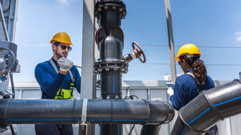
This section explains why inspecting water networks across Australia’s vast and isolated regions is operationally complex and increasingly unsustainable using traditional methods alone.
Key Takeaways
- Satellite imagery enables faster inspection of remote water distribution networks.
- Multispectral and thermal analysis help detect hidden leaks and infrastructure failures early.
- AI and GIS improve predictive maintenance across large-scale utility systems.
- Drone and aerial surveys validate satellite-detected anomalies with high-resolution detail.
Networks Spanning Thousands Of Remote Kilometres
Water distribution systems in Australia often stretch across extreme distances, particularly in rural and outback regions where communities rely on long transmission mains. These outback water networks frequently pass through deserts, floodplains, and sparsely populated corridors, making physical inspections rare and logistically demanding.
Many regional water utilities must prioritise only high-risk segments due to resource constraints, leaving large sections unmonitored for long periods.
This geographic spread makes consistent visibility nearly impossible without remote technologies like satellite imagery water systems that provide macro-level oversight of infrastructure conditions.
High Cost Of Manual Field Inspections
Field inspections across remote regions require specialised vehicles, trained crews, accommodation logistics, and safety planning, especially in extreme climates.
Plus, these costs escalate quickly when inspectors must travel hundreds of kilometres for single asset checks. For many utilities, routine patrols are no longer economically viable at scale. This has led to a growing shift toward satellite aerial imagery water distribution inspection, which significantly reduces operational expenditure by replacing frequent site visits with data-driven monitoring cycles.
The cost disparity becomes even more evident when comparing manual inspections with automated earth observation data streams that continuously update asset conditions.
Climate And Terrain Limiting Ground Access
It is not a secret that Australia’s harsh environmental conditions, including flooding, bushfires, and extreme heat, frequently restrict physical access to pipeline corridors. Sandy deserts, dense bushland, and erosion-prone zones further complicate inspection routes.
In many cases, crews are unable to reach infrastructure when it is most vulnerable.
This is where remote sensing water technologies offer a strategic advantage, allowing utilities to monitor infrastructure even during inaccessible periods.
When deploying synthetic aperture radar, operators can detect surface changes regardless of cloud cover or lighting conditions, improving situational awareness in real time.
Why Traditional Methods Cannot Scale
Conventional inspection methods rely heavily on periodic site visits, which cannot match the scale and complexity of national water infrastructure. As networks expand, inspection intervals widen, increasing the risk of undetected failures.
This lack of scalability results in delayed response times and higher water loss rates. Traditional approaches also struggle to integrate real-time data from multiple sources, limiting predictive capability.
Modern systems using satellite aerial imagery, water distribution inspection bridge this gap by enabling continuous monitoring across entire networks. It offers scalable visibility that manual inspections cannot achieve.
What Satellite Imagery Offers Water Utilities
Modern satellite aerial imagery water distribution inspection enables utilities to observe infrastructure at a regional scale without deploying crews, turning passive landscapes into measurable datasets. This approach is especially valuable for Landsat water distribution monitoring, where long-term historical imagery helps identify gradual network deterioration trends across remote corridors.
Each Image Covering 40 km² of the network
Did you know that a single satellite pass can capture approximately 40 km2 image coverage, allowing operators to observe entire pipeline corridors, reservoirs, and surrounding terrain in one frame?
This wide coverage reduces the blind spots, common in ground-based inspection programmes.
In practice, utilities can overlay infrastructure maps onto imagery to identify potential stress zones, leak indicators, and environmental changes. When integrated with high-resolution imagery, this allows engineers to zoom between macro and micro perspectives, improving decision-making without requiring physical field presence.
30,000 Km Of Systems Captured Remotely
Across Australia, more than 30,000 km of water systems in remote regions can now be monitored using satellite platforms rather than physical patrols. This scale of observation transforms how utilities prioritise maintenance, as entire transmission networks can be assessed within hours instead of months.
The ability to process such vast infrastructure datasets supports satellite aerial imagery water distribution inspection workflows that continuously flag anomalies across dispersed assets.
It also reduces dependency on seasonal inspection schedules that previously left long monitoring gaps.
Landsat Data Detecting Pipe Anomalies
Landsat data plays a critical role in detecting subtle environmental changes associated with buried pipeline failures.
Through multispectral analysis, it identifies surface disturbances that may indicate leaks, corrosion, or subsurface shifts. In Landsat water distribution monitoring, long-term image archives allow engineers to compare historical baselines against current conditions, revealing gradual degradation patterns.
This method is especially effective in sandy or vegetated terrain where direct visual inspection is impossible. It supports early-stage anomaly detection before structural failure occurs.
Monitoring Without Field Crew Deployment
One of the most significant advantages of satellite aerial imagery water distribution inspection is the ability to eliminate routine field deployment for preliminary assessments.
Instead of sending crews to investigate every suspected issue, utilities can validate risks remotely using layered satellite datasets. This includes thermal, optical, and radar-based observations that highlight environmental inconsistencies.
Since it reduces unnecessary dispatches, utilities improve safety, lower operational costs, and increase response efficiency across vast outback water networks, where travel times can otherwise exceed several days.
How Multispectral Imaging Detects Network Issues
Multispectral technologies enhance satellite aerial imagery water distribution inspection by capturing data beyond visible light, allowing utilities to interpret underground and surface-level changes simultaneously.
Soil Moisture Anomalies Above Pipe Routes
Through soil moisture mapping, multispectral sensors detect unusual wetness patterns above buried pipelines. These anomalies often indicate slow leaks or structural weaknesses in distribution lines.
When compared over time, moisture variations help engineers pinpoint emerging issues before surface damage becomes visible.
In leak detection remote workflows, even minor deviations in moisture distribution can signal hidden pipeline failures. Further, it enables proactive maintenance scheduling and reduces long-term infrastructure degradation.
Ground Subsidence Linked To Pipe Failures
Ground subsidence is a key indicator of underground pipeline leakage or structural collapse.
Multispectral imaging detects subtle surface depressions that may not be visible to ground crews. Over time, repeated satellite passes reveal progressive sinking patterns linked to pipe deterioration. This is especially relevant in sandy or clay-heavy soils where structural shifts occur gradually.
When they integrate subsidence data into satellite aerial imagery water distribution inspection, utilities can map high-risk zones before catastrophic failure occurs.
Vegetation Stress Revealing Underground Leaks
It is clear that changes in vegetation health often signal hidden water leaks beneath the surface. Through vegetation stress analysis, multispectral sensors detect abnormal growth or decay patterns caused by excess moisture or contamination.
Lush patches in arid regions may indicate underground leakage, while dying vegetation may signal pipe corrosion or contamination.
This indirect detection method allows utilities to identify failures without excavation, significantly improving inspection efficiency across remote sensing water environments.
NDVI Tracking Surface Changes Over Pipe Corridors
The NDVI index is widely used to measure vegetation health and detect environmental anomalies above infrastructure corridors.
In pipeline monitoring, NDVI variations highlight subtle ecological changes caused by underground water movement or soil disruption. When integrated into satellite aerial imagery, water distribution inspection, NDVI time-series analysis provide early warning signals of pipeline stress.
This way, engineers can track changes over time, enabling predictive maintenance strategies based on environmental response patterns rather than reactive inspections.
How Drone And Aerial Imagery Complement Satellite Data
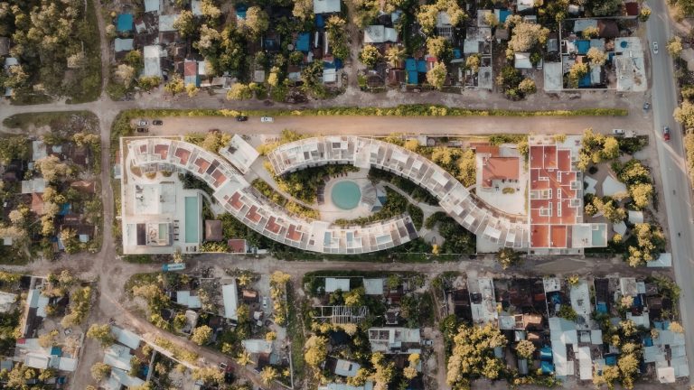
In advanced satellite aerial imagery water distribution inspection, drones and aircraft act as the ‘second lens,’ validating anomalies detected from orbit. This layered approach is increasingly adopted in aerial survey pipeline inspection Australia, where utilities combine altitude-based intelligence with high-resolution verification for faster decision cycles.
Thermal Imaging Detecting Pipe Temperature Anomalies
Drone thermal imaging is used to identify temperature differences along pipeline corridors, revealing potential leaks or pressure irregularities.
Heat signatures often shift when water escapes underground, altering surface thermal balance. In thermal anomaly detection, even minor deviations can indicate early-stage pipe failure.
When integrated with satellite alerts, thermal drone scans confirm whether anomalies detected in satellite aerial imagery water distribution inspection require immediate intervention or further monitoring, improving operational prioritisation.
UAV Surveys Covering Hard-To-Reach Terrain
UAV pipeline inspection enables utilities to access steep valleys, dense bushland, and flood-prone zones where ground crews cannot safely operate. These aerial systems can fly predefined routes, capturing continuous visual data of pipeline corridors.
In inaccessible terrain, UAVs provide near-real-time validation of satellite-flagged risks, reducing uncertainty in remote asset monitoring.
This is particularly useful across remote Australia inspection zones where environmental hazards often restrict manual access for extended periods.
High-Resolution Inspection Of Above-Ground Assets
While satellites detect broad anomalies, high-resolution imagery from drones allows engineers to inspect valves, junctions, pumps, and exposed pipeline sections in detail. This supports condition-based maintenance by identifying corrosion, cracks, or mechanical wear.
Moreover, in satellite aerial imagery water distribution inspection, this level of detail helps confirm whether detected anomalies are infrastructure-related or environmental noise. It also improves documentation accuracy for compliance reporting and asset lifecycle tracking.
LiDAR Mapping Pipe Elevation And Surface Conditions
LiDAR scanning provides precise 3D elevation models of terrain and infrastructure corridors, enabling utilities to detect subtle surface deformation linked to underground pipe stress.
When combined with aerial imagery, LiDAR builds a spatial understanding of pipeline alignment, slope, and structural vulnerability.
In the GIS water mapping Australia realm, LiDAR data enhances decision-making by adding elevation intelligence to visual datasets. This integration strengthens predictive maintenance by identifying areas prone to erosion, subsidence, or structural shifting.
How Satellite Data Detects Non-Revenue Water Losses
In modern satellite aerial imagery water distribution inspection, non-revenue water (NRW) detection has become one of the most impactful applications.
Surface Saturation Patterns Above Active Leaks
Non-revenue water satellite detection often begins with identifying abnormal surface saturation. Did you know this?
When underground pipelines leak, excess moisture rises to the surface, creating damp zones visible in multispectral and optical imagery.
These patterns are especially useful in arid regions where unexpected moisture is highly unusual. In satellite imagery water analysis, saturation mapping allows engineers to isolate potential leak clusters before they escalate into major system losses.
Cross-Referencing Imagery With Flow And Pressure Data
Satellite insights become significantly more powerful when combined with hydraulic datasets. By integrating imagery with flow and pressure readings, utilities can validate whether observed anomalies correspond to real system inefficiencies.
In AI remote sensing water assets, this fusion of datasets improves diagnostic accuracy and reduces false positives. It also allows engineers to identify whether pressure drops are caused by physical leaks or operational fluctuations within the network.
Flagging High-Loss Zones For Field Verification
Once anomalies are confirmed, utilities can prioritise field inspections only in high-risk areas rather than scanning entire networks. This targeted approach improves efficiency in satellite aerial imagery water distribution inspection, reducing unnecessary travel and inspection time.
Further, high-loss zones identified through satellite analytics are flagged for immediate verification, ensuring resources are deployed where they are most needed.
This is particularly valuable in regional water utilities managing large, sparsely populated service areas.
Reducing NRW Investigation Costs Network-Wide
Since it narrows the inspection scope and improves detection accuracy, utilities significantly reduce the cost of NRW investigations.
Instead of broad manual surveys, they rely on remote sensing insights to guide maintenance strategies. In non-revenue water management, this shift enables continuous monitoring rather than periodic audits.
Over time, the financial savings accumulate as leak detection becomes faster, more precise, and less dependent on field-based exploration.
How Satellite Imagery Monitors Water Quality Remotely
In modern satellite aerial imagery, water distribution inspection and water quality monitoring extend beyond pipelines into reservoirs, rivers, and storage systems connected to distribution networks. This is particularly important for multispectral water quality monitoring Australia, where water sources are widely dispersed across remote basins and climatic zones.
Multispectral Detection Of Algal Bloom Growth
Multispectral imaging enables the detection of algal bloom formation by analysing how water bodies reflect different wavelengths of light.
Changes in reflectance patterns often indicate biological growth before it becomes visible at the surface level.
In algal bloom detection, early identification is critical for preventing contamination spread into downstream systems.
When integrated into satellite aerial imagery, water distribution inspection, utilities gain early warning capability across reservoirs that would otherwise require manual sampling visits.
Chlorophyll Concentration Mapping From Landsat
Using Landsat data, engineers can estimate chlorophyll concentration levels across lakes and reservoirs. Elevated chlorophyll often signals nutrient overload or algal proliferation, which can compromise potable water quality.
This method allows continuous remote assessment instead of periodic lab testing alone.
In water quality monitoring, chlorophyll mapping helps identify seasonal risks and supports proactive treatment planning before water enters the distribution network.
Turbidity And Contamination Detection Across Water Bodies
Turbidity mapping uses spectral scattering analysis to detect suspended particles in water, indicating sediment inflow, contamination, or erosion impacts upstream. In satellite imagery water systems, turbidity anomalies often highlight catchment disturbances caused by storms or land-use changes.
This is particularly important for protecting intake points in regional water utilities, where contamination events can rapidly affect large populations if not detected early through satellite aerial imagery water distribution inspection.
Early Warning For Harmful Algal Bloom Events
By combining spectral time-series data with environmental thresholds, satellites can provide early warnings of harmful algal bloom development.
These systems track water colour changes, temperature shifts, and nutrient indicators over time. In remote sensing water environments, early alerts help utilities adjust treatment processes before toxins enter distribution systems.
This predictive capability reduces health risks and improves resilience in water supply chains across remote Australia inspection regions.
How AI Enhances Remote Sensing For Water Networks
In advanced satellite aerial imagery water distribution inspection, AI acts as the interpretive layer that converts complex imagery into structured insights.
AI Processing Satellite Imagery At Scale
AI remote sensing water systems process millions of pixels across large geographic regions, identifying patterns that would be impossible for human analysts to detect manually. These systems classify land surface changes, moisture anomalies, and infrastructure stress signals in near real time.
When automating analysis of earth observation data, utilities can continuously monitor entire networks without increasing operational workload or staffing requirements.
Machine Learning Detecting Anomalies Network-Wide
Machine learning models trained on historical infrastructure failures can detect early warning signs of leaks, corrosion, or pressure imbalance.
In satellite aerial imagery water distribution inspection, anomaly detection models compare current imagery against baseline conditions to flag deviations.
These models improve over time, learning from confirmed incidents and reducing false positives across expanding datasets.
Predictive Models Forecasting Failure From Imagery Trends
Predictive analytics uses time-series imagery to forecast potential pipeline failures before they occur. By analysing trends such as soil moisture variation, vegetation stress, and surface deformation, AI models estimate risk probability across network segments.
In systems using synthetic aperture radar, even subtle ground changes can be incorporated into predictive frameworks.
The latter enables utilities to prioritise preventive maintenance instead of reactive repairs.
Automated Alerts For Detected Surface Anomalies
Once anomalies are detected, AI systems generate automated alerts that integrate directly into asset management platforms.
These alerts include location tagging, severity scoring, and historical comparison data.
In satellite aerial imagery water distribution inspection, this reduces response time dramatically, allowing engineers to focus only on verified high-risk zones rather than scanning entire datasets manually.
How GIS Integrates Satellite And Aerial Data
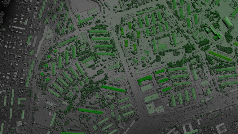
Modern satellite aerial imagery water distribution inspection relies heavily on GIS platforms to merge satellite, aerial, and sensor data into a single operational view. This integration allows utilities to visualise infrastructure health spatially, improving decision-making and long-term planning.
3D GIS Models Combining Imagery And Asset Data
A 3D GIS model integrates elevation data, pipeline routes, and satellite imagery into a unified spatial environment. This enables engineers to visualise underground infrastructure in relation to surface conditions. By layering multiple datasets, utilities can assess structural risk zones and environmental stress factors simultaneously, improving maintenance prioritisation across complex networks.
Mapping Failure Risk Zones Across The Network
GIS platforms use spatial analytics to identify high-risk pipeline segments based on historical failures, environmental conditions, and satellite observations.
In GIS water mapping Australia, these risk zones are continuously updated as new data becomes available.
This allows utilities to shift from static maps to dynamic risk models that evolve with real-time conditions.
Overlaying Satellite Findings With IIoT Sensor Readings
When combining satellite insights with IIoT sensor data, utilities gain a multi-layered understanding of network performance. Pressure sensors, flow meters, and leak detectors validate satellite-identified anomalies.
In satellite aerial imagery water distribution inspection, this cross-validation improves confidence in detection accuracy and reduces unnecessary field investigations.
Dynamic Maps Updated With Each New Satellite Pass
GIS platforms continuously refresh spatial layers as new satellite passes provide updated imagery. This ensures that infrastructure maps remain current, reflecting recent environmental or structural changes.
In digital twin water environments, these updates support near-real-time modelling of system behaviour, enhancing operational responsiveness across large-scale utility networks.
How Digital Twin Uses Remote Sensing Data
In advanced satellite aerial imagery water distribution inspection, digital twin systems act as living replicas of physical infrastructure, continuously updated using remote sensing inputs. By integrating digital twin water environments with satellite and aerial datasets, operators gain a continuously evolving operational mirror of their entire distribution network.
Feeding Satellite Imagery Into The Virtual Network
Satellite feeds are continuously ingested into digital twin platforms, updating terrain, moisture levels, and infrastructure surroundings. This ensures that the virtual model reflects real-world conditions with minimal delay.
In satellite imagery water systems, this process transforms static infrastructure models into dynamic environments capable of responding to environmental changes across inaccessible terrain in near real time.
Simulating Failure Scenarios From Surface Anomaly Data
When anomalies such as subsidence or vegetation stress are detected, digital twins simulate possible failure pathways.
These simulations help engineers understand how minor surface changes could evolve into major pipeline failures.
In satellite aerial imagery water distribution inspection, this predictive simulation capability reduces uncertainty and improves decision-making for long-term asset planning.
Validating Predictions Against Aerial Findings
Digital twin outputs are continuously validated using UAV and satellite observations. When aerial data confirms predicted anomalies, model accuracy improves over time. In workflows involving UAV pipeline inspection, this feedback loop strengthens system reliability and reduces false prediction rates.
It also ensures that decision-making remains grounded in real-world environmental conditions rather than purely theoretical models.
Continuous Sync Between Satellite Data And Digital Twin
A continuous data pipeline ensures that satellite updates, including Earth Observation data, are synchronised with the digital twin.
This creates a near real-time reflection of infrastructure health across the network.
In satellite aerial imagery water distribution inspection, this synchronisation allows utilities to monitor evolving risks and respond faster to emerging issues across distributed assets.
Key Benefits Over Traditional Inspection Methods
Modern satellite aerial imagery water distribution inspection significantly outperforms conventional field-based inspections by providing broader coverage, faster insights, and reduced operational risk. It enables utilities to transition from reactive maintenance models to predictive, data-driven infrastructure management.
Eliminating Field Crews In Remote Locations
One of the most immediate benefits is the reduction in physical inspections across dangerous or isolated areas.
Instead of deploying crews into harsh environments, utilities rely on remote sensing to assess conditions. This is particularly valuable across outback water networks, where travel time and safety risks are high.
Also, remote monitoring improves efficiency while reducing exposure to environmental hazards.
Detecting Issues Invisible To Ground Inspection
Many pipeline issues, such as subsurface leaks or early-stage deformation, are invisible from ground level. Satellite systems detect these through spectral and thermal variations.
In satellite aerial imagery water distribution inspection, this capability ensures hidden failures are identified before they escalate into system-wide disruptions.
Covering Vast Networks In Hours, Not Months
Traditional inspections can take months to complete across large regions, while satellite systems can analyse entire networks in hours.
With 30,000 km water systems under observation, this scalability transforms operational timelines.
Utilities can now respond to infrastructure issues in near real time rather than waiting for scheduled inspection cycles.
Reducing Safety Risks For Inspection Personnel
When reducing field deployment requirements, utilities significantly lower their exposure to hazardous conditions such as floods, bushfires, and extreme heat.
Remote sensing ensures that only verified high-risk sites require physical inspection, improving overall workforce safety while maintaining high infrastructure oversight standards.
Common Gaps Without Remote Inspection Technology
Without satellite aerial imagery water distribution inspection, utilities often operate with incomplete visibility, leading to delayed responses and increased system losses.
Leaks Undetected For Months In Remote Areas
In the absence of continuous monitoring, leaks can persist unnoticed for long periods, especially in isolated regions. This leads to significant water loss and infrastructure damage.
Without non-revenue water tracking through remote systems, utilities struggle to identify inefficiencies early enough to prevent escalation.
Manual Inspection Missing Subsurface Deterioration
Ground inspections often fail to detect underground issues such as pipe corrosion or structural weakening. These failures remain hidden until major breakdowns occur.
Without pipe corrosion detection capabilities from remote sensing, utilities are forced into reactive maintenance cycles.
Water Quality Events Identified Too Late
Without spectral monitoring, contamination events such as algal blooms or turbidity spikes may only be detected after affecting distribution systems.
This delay can compromise treatment efficiency and public safety. Remote sensing helps detect early-stage algal bloom detection signals before they reach critical levels.
High NRW From Undetected Remote Losses
Non-revenue water losses remain one of the biggest inefficiencies in traditional systems. Without satellite-based monitoring, utilities struggle to identify leakage clusters in time.
This results in persistent financial losses and inefficient resource allocation across regional water utilities.
How To Integrate Satellite Imagery Into Asset Management
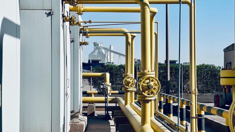
Integrating satellite aerial imagery water distribution inspection into asset systems requires structured data pipelines, training, and operational alignment. When implemented correctly, it transforms how utilities manage infrastructure lifecycle planning and maintenance scheduling.
Establishing A Satellite Data Analytics Baseline
The first step is creating a baseline of normal network conditions using historical imagery. This allows systems to detect deviations over time.
In remote sensing water applications, baselines are essential for distinguishing between natural environmental changes and actual infrastructure risks.
Connecting Imagery Outputs To GIS And Asset Platforms
Satellite outputs must be integrated into GIS and asset management systems to become operationally useful.
This ensures that spatial insights are directly linked to infrastructure records. In GIS water network mapping Australia, this integration improves traceability and decision accuracy across asset lifecycles.
Training Asset Managers On Remote Sensing Data
Operational teams must understand how to interpret satellite-derived indicators such as moisture anomalies, vegetation shifts, and thermal variations.
Training ensures that insights from AI remote sensing water assets are correctly translated into maintenance actions rather than overlooked or misinterpreted.
Scheduling Satellite Passes Aligned With Inspection Cycles
Utilities should align satellite revisit schedules with maintenance planning cycles to ensure consistent monitoring.
Regular imaging allows continuous assessment of infrastructure health and improves long-term planning efficiency.
This structured approach enhances the effectiveness of satellite aerial imagery water distribution inspection across large-scale systems.
Why Choose Tigernix For Remote Network Inspection
Tigernix provides integrated software solutions, such as the Water Distribution Asset Solution, for satellite and aerial imagery-based water distribution inspection, combining analytics, AI, and spatial intelligence tailored for Australian utility environments. Its systems are designed for scalability across remote and high-risk infrastructure zones.
Patented Satellite Analytics For Australian Water Utilities
Tigernix offers advanced analytics models specifically designed for remote Australia inspection challenges. These models are tuned to detect environmental and infrastructure anomalies unique to Australian climates and terrain conditions.
Landsat And Multispectral Imaging Covering 40 Km2
The platform leverages Landsat data and multispectral systems capable of analysing 40 km2 image coverage per pass, enabling large-scale monitoring without operational bottlenecks.
AI-Powered Anomaly Detection Across Remote Networks
Using AI remote sensing water algorithms, the system automatically detects leaks, deformation, and vegetation anomalies across distributed infrastructure, improving detection speed and accuracy.
GIS, Digital Twin, And IIoT Integrated With Satellite Data
Tigernix integrates 3D GIS model systems, digital twin water platforms, and IIoT sensor networks into a unified ecosystem for real-time infrastructure intelligence.
Trusted Across Remote Australian Water Utility Regions
The platform is widely adopted in regional water utilities operating in challenging terrains, where traditional inspection methods are limited or cost-prohibitive.
Tigernix- Ensuring Water Distribution Perfection
Ready To Inspect Your Remote Network From Above?
By adopting integrated satellite, drone, and AI systems, utilities can modernise inspection workflows, reduce losses, and improve resilience across vast water distribution systems.
Consult Tigernix Satellite And Remote Sensing Specialists
Utilities can engage experts to design tailored satellite aerial imagery water distribution inspection strategies aligned with operational and environmental requirements.
Call for a free demo.
Explore Tigernix Satellite Data Analytics Capabilities
Stakeholders can evaluate how advanced analytics transform raw imagery into actionable infrastructure intelligence across distributed networks.
FAQ About Satellite Aerial Imagery Water Distribution Inspection
It improves accuracy by combining multispectral and thermal signals to identify soil moisture anomalies, vegetation stress, and surface deformation patterns. These indicators help detect hidden leaks earlier than ground surveys, especially across remote pipeline corridors and inaccessible terrain.
Landsat 8 data provides long-term multispectral imagery used to track environmental changes above pipelines and reservoirs. It supports the detection of chlorophyll shifts, turbidity variation, and surface moisture anomalies, enabling utilities to monitor infrastructure trends over time without physical inspections.
Drones provide high-resolution validation of satellite-detected anomalies using thermal imaging and visual surveys. They inspect valves, pipelines, and terrain conditions in detail, especially in hard-to-reach regions, improving confirmation accuracy and reducing unnecessary field deployment.
Yes, satellite systems identify non-revenue water by detecting surface saturation patterns, subsidence, and vegetation anomalies linked to underground leaks. When combined with pressure and flow data, they help utilities isolate high-loss zones for targeted field verification.
AI processes large-scale Earth Observation data to detect anomalies, classify risk zones, and predict pipeline failures. Machine learning models continuously improve detection accuracy by analysing historical leak patterns, enabling automated alerts and predictive maintenance planning across networks.