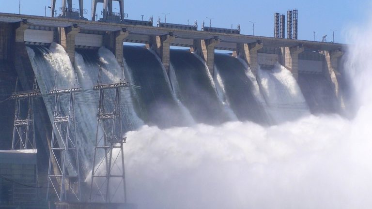
Australia’s dam infrastructure carries one of the largest operational risk burdens in the Asia-Pacific region, with more than 80,000 gigalitres of stored water supporting agriculture, mining, hydroelectricity, and urban consumption. According to industry reporting from the Australian National Committee on Large Dams, the country manages over 490 regulated large dams, creating immense pressure for operators to modernise compliance and monitoring frameworks.
Traditional inspection practices alone are no longer sufficient for managing evolving climate variability, structural ageing, and regulatory expectations. Modern operators now require intelligent monitoring ecosystems capable of delivering predictive analysis, automated compliance visibility, and operational resilience.
This is where ANCOLD dam safety guidelines Australia become increasingly important for water authorities and infrastructure operators seeking sustainable, technology-driven governance.
This article covers
- What ANCOLD Guidelines Require from Dam Operators
- The Scale Of Australian Dam Safety Responsibility
- How IIoT Sensors Enable Continuous Structural Monitoring
- How AI Predicts Dam Failure Before It Occurs
- How Digital Twin Supports ANCOLD Compliance
- How Flood Inflow Forecasting Supports Dam Safety
- How GIS Mapping Supports Hazard Classification
- How Satellite Data Enhances Dam Wall Monitoring
- How Automated Compliance Reporting Meets ANCOLD Requirements
- How The Simulated Dam Operational Model Works
- Common Compliance Gaps Without Smart Dam Monitoring
- How To Build An ANCOLD-Aligned Dam Safety Programme
- FAQs About Dam Safety Management
What ANCOLD Guidelines Require from Dam Operators
Australian dam operators must comply with strict engineering, operational, and emergency planning standards designed to minimise public safety and environmental risks.
Key Takeaways
- Real-time structural monitoring improves early detection of seepage, displacement, and vibration anomalies before they escalate into critical failures.
- AI-driven predictive analytics enable failure forecasting, risk scoring, and proactive maintenance planning for large dam portfolios.
- GIS mapping and satellite integration enhance hazard classification accuracy and improve downstream risk visibility across catchment areas.
- Automated compliance reporting streamlines ANCOLD-aligned documentation, improving audit readiness and reducing manual reporting workload.
ANCOLD as Australia’s National Dam Safety Standard
The framework established under ANCOLD guidelines defines engineering expectations for surveillance, operational governance, risk assessment, and infrastructure resilience.
It serves as the national benchmark for Australian dam safety management. The latter helps operators maintain consistent technical practices across both public and privately managed water infrastructure systems.
Hazard Classification and Consequence Categories Explained
Under hazard classification frameworks, dams are assessed according to downstream exposure, economic impact, environmental harm, and potential loss of life.
Every consequence category determines the intensity of monitoring obligations, engineering reviews, operational controls, and emergency preparedness required by regulators and infrastructure owners.
Dam Safety Review Requirements and Inspection Cycles
A formal dam safety review DSR evaluates structural performance, operational adequacy, hydrological assumptions, and long-term infrastructure reliability.
Reviews are conducted at scheduled intervals. This depends on risk exposure, asset age, and regulatory expectations, to ensure operators maintain up-to-date safety documentation and engineering assurance programmes.
Emergency Action Plan Obligations for High-Hazard Dams
Operators managing high-consequence infrastructure must maintain an emergency action plan EAP outlining evacuation procedures, communication workflows, flood response coordination, and operational escalation pathways.
Authorities increasingly require plans that incorporate predictive analytics and dynamic flood modelling to enable faster decision-making during severe rainfall events.
The Scale of Australian Dam Safety Responsibility
Australia’s dam infrastructure network spans multiple states, environmental conditions, and operational risks, creating highly complex governance responsibilities.
490+ Large Dams on the ANCOLD Register
The dam register ANCOLD includes hundreds of regulated assets exceeding the recognised 15m height threshold for large dams.
These structures support water supply, mining, irrigation, and hydroelectric generation.
They require operators to implement increasingly advanced monitoring systems capable of supporting large-scale infrastructure governance.
80,000 Gigalitres of Dammed Water Under Management
Australia’s extensive reservoir network stores enormous water volumes essential to national productivity. This level of storage complexity significantly increases pressure on operators to maintain long-term infrastructure resilience, hydrological accuracy, and public safety standards.
It is a must to balance operational efficiency and environmental protection obligations.
State-Level Compliance from NSW, Victoria, and Queensland
Authorities such as the NSW Dam Safety Committee enforce region-specific oversight obligations aligned with broader state dam regulations.
Operators must often navigate differing compliance structures, engineering reporting formats, operational thresholds, and environmental responsibilities depending on the jurisdiction governing individual dam portfolios.
Why Conventional Monitoring Cannot Meet Modern Requirements
Traditional inspections cannot consistently detect rapidly evolving structural problems, especially during severe rainfall events or operational stress periods.
Manual surveillance methods often lack sufficient data granularity.
They delay risk visibility and limit proactive response capabilities required by modern regulatory frameworks and climate-driven operational conditions.
How IIoT Sensors Enable Continuous Structural Monitoring
Modern smart infrastructure uses sensor-driven intelligence to monitor structural behaviour continuously instead of relying solely on periodic inspections.
Piezometer and Seepage Sensors Tracking Dam Wall Health
Advanced IIoT dam sensors collect continuous piezometer readings and support accurate seepage detection throughout embankments and foundations.
These sensors provide engineers with early visibility into pressure changes, internal erosion risks, and groundwater movement that may compromise long-term infrastructure reliability.
Displacement and Vibration Monitoring in Real Time
Continuous displacement monitoring and vibration monitoring systems measure structural movement, stress fluctuations, and mechanical instability across critical infrastructure components.
Real-time engineering visibility enables operators to detect abnormal behavioural trends before they escalate into severe operational or safety incidents.
Automated Alerts When Structural Readings Breach Thresholds
Modern monitoring platforms automatically trigger alerts whenever operational readings exceed predefined engineering tolerances.
This enables faster maintenance intervention, immediate escalation workflows, and improved protection of public infrastructure while supporting stronger engineering accountability across distributed dam management operations.
Replacing Periodic Manual Inspections with Continuous Data
Modern real-time structural monitoring platforms continuously analyse operational behaviour instead of relying entirely on scheduled site visits.
Continuous visibility improves engineering responsiveness and reduces blind spots between inspections. Plus, it supports faster detection of structural deterioration across geographically dispersed infrastructure networks.
How AI Predicts Dam Failure Before It Occurs
Artificial intelligence allows operators to identify infrastructure instability patterns far earlier than conventional analytical methods.
AI Models Identifying Anomalies in Structural Sensor Data
Machine learning systems continuously analyse sensor trends to identify abnormal pressure shifts, deformation behaviour, seepage fluctuations, and thermal inconsistencies.
These systems improve visibility into changing infrastructure conditions. Further, they help engineers prioritise operational responses based on evolving structural risk patterns.
Predicting Risk Levels and Failure Date Estimates
Advanced AI failure prediction engines evaluate historical behaviour, climate exposure, and operational stress indicators to estimate future failure probabilities.
This supports the development of predictive dam analytics that can forecast deterioration patterns and identify infrastructure vulnerabilities before significant escalation occurs.
Asset Confidence and Reliability Scoring per Dam Asset
AI-driven scoring frameworks evaluate infrastructure reliability based on operational consistency, sensor stability, historical maintenance performance, and environmental stress exposure. These confidence ratings help authorities prioritise maintenance budgets and improve inspection scheduling.
Not to mention, they support and strengthen long-term asset management planning strategies.
Early Detection Reducing Risk Before Regulatory Escalation
Early anomaly identification enables operators to address emerging structural issues before they develop into reportable regulatory breaches or public safety concerns. Faster intervention also reduces operational downtime, emergency expenditure, and long-term infrastructure rehabilitation costs for large dam operators.
How Digital Twin Supports ANCOLD Compliance
Digital twin environments provide engineering teams with simulation-based operational visibility for infrastructure planning and regulatory validation.
2D and 3D Dam Visualisation for Operational Insight
Advanced 2D 3D dam visualisation environments help engineers observe infrastructure conditions, stress zones, hydrological changes, and operational dependencies in highly intuitive formats.
This enhances situational awareness and improves collaboration between engineering teams, emergency planners, and compliance authorities.
Simulating Stress Behaviour and Inflow Scenarios
A modern digital twin dam environment enables engineers to simulate changing hydrological loads, structural stress responses, and operational disruptions under varying climate conditions.
These simulations support proactive infrastructure planning and improve engineering confidence during high-risk operational periods.
Testing Dam Responses to Probable Maximum Flood Events
Simulation environments allow engineers to model infrastructure performance during a probable maximum flood scenario.
Operators can evaluate spillway capacity, structural resilience, emergency discharge behaviour, and evacuation readiness while identifying vulnerabilities requiring mitigation before real-world flood conditions occur.
Validating Emergency Action Plans Through Virtual Scenarios
Advanced simulation platforms help operators validate emergency response workflows through dynamic flood scenario modelling exercises. Virtual testing improves communication coordination, evacuation timing, operational readiness, and infrastructure resilience while reducing uncertainty during high-pressure emergency situations.
How Flood Inflow Forecasting Supports Dam Safety
Forecast-driven operational planning helps dam operators respond proactively to changing hydrological conditions before severe flooding develops.
7-Day River Height and Rainfall Gauging Forecasts
Advanced hydrological systems support 7-day rainfall forecasting and continuous river height gauging to improve operational awareness. These predictive capabilities help operators anticipate changing catchment conditions.
Also, they optimise discharge planning and strengthen emergency preparedness before severe weather impacts infrastructure performance.
Basin Evaporation and Soil Moisture Level Predictions
Continuous soil moisture monitoring and basin evaporation forecasting improve catchment visibility by identifying changing runoff potential, saturation levels, and hydrological stress conditions.
These environmental indicators strengthen forecasting accuracy and help operators prepare for rapidly evolving inflow behaviour during severe rainfall periods.
AI-Driven Inflow Forecasting for Gate Release Planning
Advanced inflow forecasting systems use rainfall trends, catchment behaviour, and hydrological modelling to optimise gate release scheduling.
The intelligent forecasts reduce downstream flood exposure.
Moreover, they are improving reservoir management efficiency during periods of elevated rainfall intensity and changing environmental conditions.
Early Flood Warning Aligned with ANCOLD EAP Requirements
Integrated forecasting systems strengthen emergency action plan dam compliance by providing earlier warning visibility during high-risk weather events. Faster situational awareness improves evacuation coordination, stakeholder communication, and operational response timing while supporting stronger alignment with emergency preparedness obligations.
How GIS Mapping Supports Hazard Classification
GIS technology transforms dam risk analysis into a highly visual and operationally actionable process for regulators and infrastructure operators.
Mapping Dam Hazard Zones and Downstream Consequence Areas
Advanced GIS hazard mapping systems visualise downstream exposure zones, infrastructure vulnerability, population density, and evacuation impact areas.
Such spatial assessments improve engineering visibility into public safety risks and strengthen infrastructure planning across complex catchment environments.
Visualising Cascade Failure Risk Across Catchment Portfolios
Modern mapping systems help operators identify interconnected infrastructure dependencies and assess cascade failure risk across multiple reservoirs, waterways, and downstream assets.
The broader operational perspective improves strategic planning for emergency response coordination and multi-asset infrastructure resilience.
Overlaying Structural Condition Data with Hazard Categories
GIS environments integrate structural performance data, maintenance history, hydrological exposure, and regulatory classifications into unified operational dashboards.
Engineers can quickly identify high-priority infrastructure risks while improving planning accuracy for inspections, maintenance, and operational interventions.
Dynamic GIS Risk Maps for State Regulator Reporting
Dynamic geospatial reporting improves communication with regulators by providing continuously updated visual intelligence.
These mapping systems strengthen infrastructure transparency. Not to mention that they help operators streamline audit submissions, engineering reviews, and long-term compliance reporting processes.
How Satellite Data Enhances Dam Wall Monitoring
Satellite technologies expand monitoring visibility beyond physical infrastructure by observing environmental and geological changes remotely.
Detecting Ground Deformation and Surface Subsidence Remotely
Satellite-based deformation analysis helps engineers detect movement patterns affecting structural integrity around embankments, foundations, and surrounding terrain.
Remote visibility supports earlier intervention planning and strengthens infrastructure resilience in geographically isolated or difficult-to-access environments.
Monitoring Upstream Catchment Conditions from Above
Remote sensing technologies provide broader visibility into vegetation stress, runoff accumulation, land-use changes, and catchment hydrology. These observations improve environmental awareness while supporting more accurate operational planning during severe weather and changing climate conditions.
Satellite Imagery Identifying Erosion Around Dam Structures
High-resolution imagery helps engineers identify erosion channels, embankment deterioration, sediment accumulation, and surface instability surrounding critical infrastructure assets.
Earlier detection improves maintenance prioritisation and reduces long-term infrastructure degradation risks across large operational environments.
Combining Satellite Data with IIoT Readings for Full Coverage
Integrated monitoring environments combine satellite intelligence with sensor analytics to strengthen dam wall monitoring accuracy.
This layered visibility approach improves operational awareness by correlating remote environmental changes with real-time structural conditions across critical infrastructure systems.
How Automated Compliance Reporting Meets ANCOLD Requirements
Automated reporting systems reduce administrative complexity while improving engineering transparency and regulatory accountability.
Automated Dam Safety Reports Aligned with ANCOLD Frameworks
Modern automated compliance reporting systems generate engineering summaries, inspection records, sensor analytics, and operational risk assessments aligned with recognised Australian compliance frameworks.
Automated workflows improve reporting consistency while reducing administrative burdens on engineering and operations teams.
Timestamped Audit Trails for All Structural Monitoring Events
Digital audit systems automatically record maintenance actions and sensor alerts. They also record engineering responses and inspection outcomes with accurate timestamps.
These detailed records strengthen governance transparency while helping operators demonstrate operational accountability during regulatory investigations and compliance audits.
State-Specific Reporting for NSW, Victoria, and Queensland
Compliance systems can customise reporting structures according to varying state requirements and operational obligations. This flexibility improves communication with authorities while helping operators manage differing documentation expectations across multi-jurisdictional infrastructure portfolios more efficiently.
Environmental Compliance Documentation for EPA Submissions
Advanced reporting platforms streamline environmental impact assessment documentation by consolidating hydrological data, discharge records, ecological monitoring, and operational activities into unified reporting workflows.
These are suitable for environmental oversight and long-term regulatory accountability.
How the Simulated Dam Operational Model Works
Simulation-driven infrastructure management enables engineers to evaluate operational risks before real-world impacts occur.
Manipulating Parameters to Predict Risk and Reliability
A sophisticated simulated dam model enables engineers to adjust rainfall intensity, reservoir pressure, operational stress, and structural variables to evaluate changing infrastructure reliability.
These simulations improve engineering decision-making by identifying vulnerabilities across different environmental and operational conditions.
Forecasting Risk Occurrence Dates per Dam Asset
Predictive simulation environments estimate when operational risks are likely to emerge based on deterioration patterns, environmental stress exposure, and historical asset performance.
The forecasts help operators prioritise maintenance scheduling and reduce unexpected infrastructure failures.
Simulating Inflow Scenarios Against ANCOLD Design Criteria
Simulation systems test infrastructure performance against engineering thresholds, spillway capacities, and hydrological assumptions defined within ANCOLD dam safety guidelines Australia.
This strengthens planning accuracy while helping operators validate operational readiness during severe environmental stress conditions.
Comparing Actual vs Desired Dam Performance Levels
Operational dashboards compare real infrastructure behaviour against engineered performance expectations, enabling faster identification of deterioration trends. Engineers can then implement targeted corrective actions before operational reliability declines beyond acceptable engineering or regulatory limits.
Common Compliance Gaps Without Smart Dam Monitoring
Conventional monitoring methods frequently leave operational blind spots that increase safety, regulatory, and infrastructure risks.
Periodic Inspections Missing Fast-Developing Structural Issues
Manual inspections may overlook rapidly evolving seepage patterns, stress changes, or structural deformation occurring between scheduled site visits.
Limited monitoring frequency reduces operational visibility and delays engineering intervention during emerging infrastructure instability events.
Manual Reports Falling Short of ANCOLD Audit Standards
Traditional reporting methods often create fragmented records, inconsistent documentation quality, and limited traceability during compliance audits.
These weaknesses reduce operational transparency and make it more difficult for operators to demonstrate proactive infrastructure governance to regulators.
Emergency Action Plans Not Tested Against Real Flood Scenarios
Many operators maintain emergency documentation without regularly validating procedures through advanced simulations.
Without realistic testing environments, response plans may fail to account for evolving hydrological conditions, operational delays, or cascading infrastructure impacts during severe flooding events.
Cascade Failure Risks Undetected Across Dam Portfolios
Disconnected monitoring systems often prevent operators from identifying interdependent infrastructure vulnerabilities across broader catchment networks. This limits visibility into how failures in one structure may influence downstream assets, operational continuity, and regional public safety exposure.
How to Build an ANCOLD-Aligned Dam Safety Programme
Building a modern compliance framework requires continuous monitoring, predictive intelligence, and integrated operational visibility.
Establishing Continuous IIoT Monitoring Across Dam Assets
Operators should implement integrated sensor ecosystems capable of continuously monitoring structural movement, seepage behaviour, hydrological changes, and operational conditions.
This strengthens engineering visibility while improving response speed during rapidly evolving infrastructure or environmental events.
Integrating Digital Twin for Scenario-Based EAP Testing
A robust digital twin dam safety Australia strategy allows operators to simulate emergency conditions, evaluate operational responses, and improve evacuation readiness.
Scenario-driven testing enhances infrastructure resilience while supporting stronger emergency preparedness and regulatory confidence across high-consequence dam operations.
Aligning GIS Hazard Maps with ANCOLD Consequence Categories
GIS intelligence should align directly with operational risk classifications, downstream exposure mapping, and emergency planning frameworks.
This improves infrastructure visibility while helping operators prioritise engineering resources according to evolving operational and public safety risks.
Embedding Automated Compliance Reporting Into Operations
Compliance reporting should operate continuously alongside infrastructure monitoring systems rather than as a separate administrative activity.
Integrated workflows improve governance transparency, reduce manual documentation burdens, and strengthen engineering accountability across large operational environments.
Why Choose Tigernix Catchment Solution for Dam Safety?
Tigernix Catchment Asset Solution is a robust system that combines predictive analytics, intelligent monitoring, and compliance automation into a unified infrastructure governance platform.
Simulated Dam Model for Risk and Reliability Forecasting
The Tigernix platform delivers advanced operational simulations capable of evaluating environmental stress conditions, infrastructure behaviour, and reliability trends. These capabilities improve engineering planning while strengthening operational preparedness for complex hydrological and structural risk scenarios.
IIoT Structural Monitoring Across Full Dam Asset Portfolios
Our solution supports enterprise-scale dam structural monitoring Australia through integrated sensor ecosystems, real-time operational analytics, and infrastructure performance visibility. Operators gain continuous awareness across geographically distributed assets without relying solely on manual inspection processes.
AI Predicting Failure Dates and Asset Confidence Levels
Tigernix platform delivers intelligent dam failure prediction IIoT Australia capabilities that identify deterioration patterns, estimate infrastructure risk progression, and generate confidence scoring for individual operational assets. This predictive visibility helps operators prioritise maintenance investments and strengthen long-term infrastructure resilience.
Automated ANCOLD-Aligned Compliance and Audit Reporting
Tigernix’s platform streamlines operational governance through automated engineering reports, audit-ready documentation, and integrated compliance workflows aligned with ANCOLD hazard classification compliance obligations. This improves reporting consistency while reducing administrative complexity across large-scale infrastructure operations.
Trusted by Australian Water Authorities Managing Large Dams
Tigernix software platform supports water authorities responsible for large infrastructure portfolios requiring advanced catchment dam risk assessment Australia capabilities. Our platform combines predictive intelligence, hydrological visibility, compliance automation, and operational forecasting into a unified environment designed for critical infrastructure governance.
Tigernix-Safety Is Ensured
Ready to Align Your Dam Safety with ANCOLD Guidelines?
As you can see, modern dam governance requires predictive visibility, continuous monitoring, and integrated compliance systems capable of supporting long-term infrastructure resilience.
Consult Tigernix Catchment and Dam Safety Specialists
Tigernix specialists help operators evaluate infrastructure risks, modernise operational workflows, and strengthen compliance strategies using advanced monitoring, predictive analytics, and simulation-driven infrastructure management technologies tailored for Australian water infrastructure environments.
Call us for a free demo.
Explore Tigernix Catchment Solution Dam Safety Features
The platform combines intelligent monitoring, flood inflow forecasting, dam Australia capabilities, predictive analytics, simulation technologies, and automated reporting into a unified operational ecosystem designed to improve infrastructure reliability and engineering responsiveness.
Implement ANCOLD-Compliant Smart Dam Monitoring Today
Modern infrastructure operators require integrated technologies capable of supporting ANCOLD dam safety guidelines Australia through predictive intelligence, automated governance, and continuous monitoring visibility. Smart operational ecosystems now play a critical role in reducing infrastructure risk and strengthening long-term public safety outcomes.
FAQs About Dam Safety Management
IIoT sensors continuously monitor seepage pressure, vibration behaviour, displacement movement, and structural stress conditions in real time. This allows dam operators to identify abnormal patterns earlier, automate compliance reporting, and reduce delays associated with manual engineering inspections and data collection processes.
Digital twin technology enables engineers to simulate flood events, structural stress conditions, and operational failures without affecting live infrastructure. These simulations improve emergency preparedness, validate spillway capacity, optimise gate operations, and strengthen decision-making during extreme hydrological or structural risk scenarios.
AI systems analyse historical sensor behaviour, environmental conditions, rainfall trends, and structural anomalies to identify deterioration patterns. Predictive models estimate infrastructure reliability, forecast potential failure timelines, and prioritise maintenance interventions before risks develop into regulatory or operational emergencies.
Accurate flood inflow forecasting requires rainfall intensity measurements, river height readings, soil saturation levels, evaporation rates, catchment runoff behaviour, and reservoir storage conditions. Combining these datasets improves hydrological prediction accuracy and supports safer operational discharge planning during severe weather events.
GIS mapping visualises downstream population exposure, flood pathways, environmental sensitivity zones, and infrastructure vulnerability areas. Engineers use this spatial intelligence to assess hazard classifications, evaluate consequence severity, improve evacuation planning, and strengthen compliance reporting for regulatory authorities and emergency management agencies.